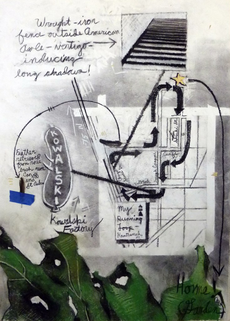
This hand drawn map by Clara DeGalan is a part of a series of hand drawn maps in a Volume 2 of Detroit Research Journal. The map is part of the “Drawing Detroit” series which aims to collect personal and hand drawn maps of Detroit.
Check out the different hand drawn and hand maps that we’ve collected over the years.
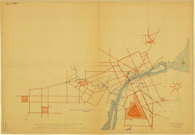
There was no Detroit Metropolitan Wayne County Airport (DTW) in 1943. That would take another 6 years for the existing Wayne County airport to add three more runways and pull air traffic away from Detroit City Airport. This map comes from the “south Detroit” side of things. Windsor was exploring a new international airport that would take up nearly half the city.
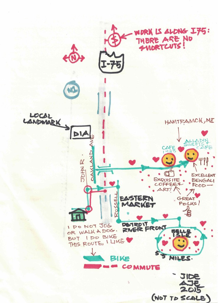
This hand drawn map by ‘jide Aje is a part of a series of hand drawn maps in a Volume 2 of Detroit Research Journal. The map is part of the “Drawing Detroit” series which aims to collect personal and hand drawn maps of Detroit.
Check out the different hand drawn and hand maps that we’ve collected over the years.
The M1 Rail project has been in the urban mass transit imagination since at least 1979. This map comes from a joint report led by the Southeastern Michigan Transportation Authority (SEMTA), from which SMART would form in future years, and the USDOT Urban Mass Transportation Administration (UMTA).
The report also explored the Downtown People Mover (DPM) option, which seems to be the only project option that was funded.
I was fascinated to see that this plan called for the M1 light rail to be subsurface (subway) from Jefferson Ave to Grand Boulevard and then aerial, like the People Mover, from Grand Blvd. to McNichols before functioning at-grade at the street level.
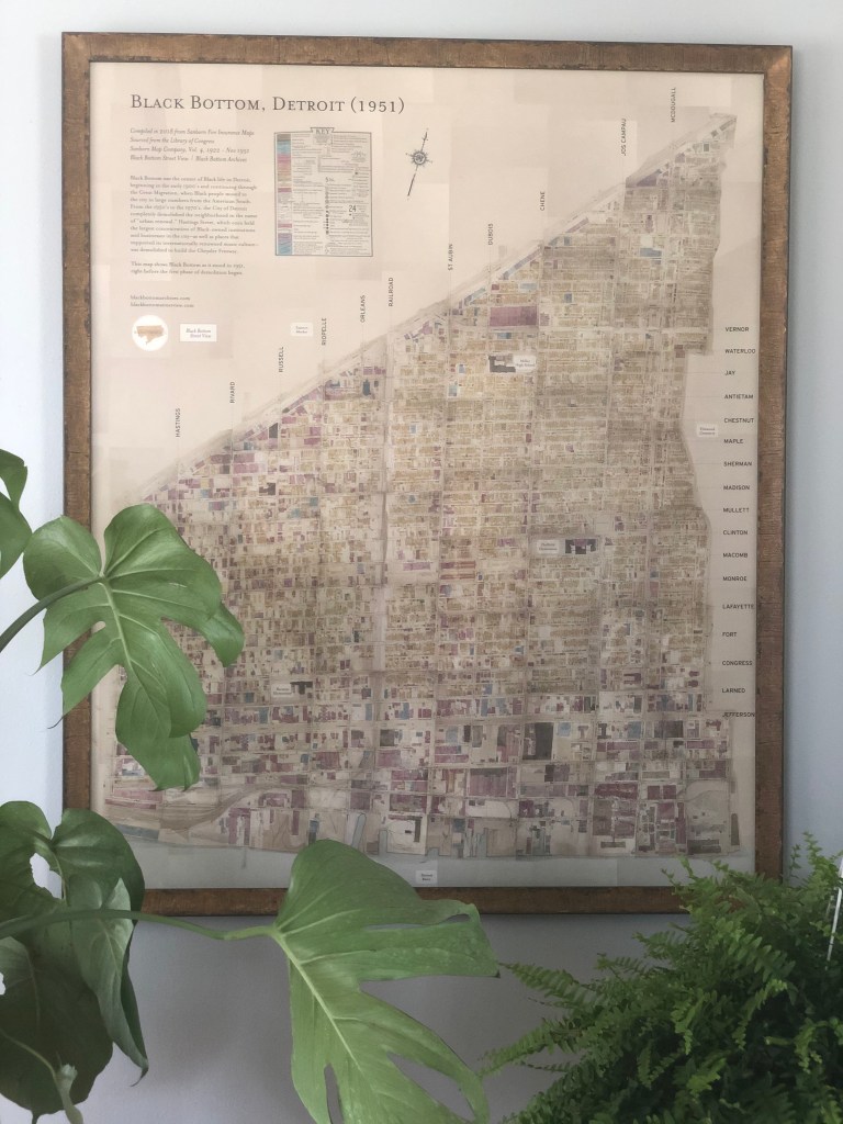
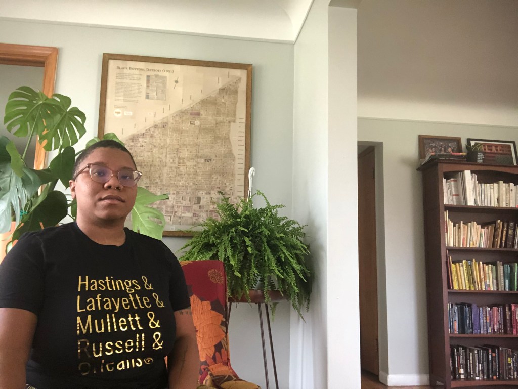
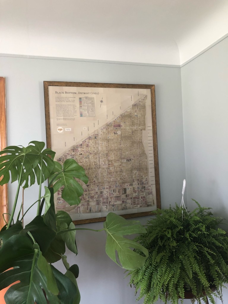
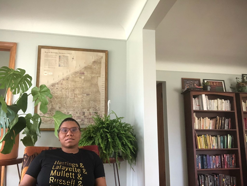
This is a digitally recreated map of the Black Bottom neighborhood as it was in 1951 by Emily Kutil, the creator of Black Bottom Street View. The map was compiled in 2018 from Sanborn Fire Insurance Maps.
Where did you find/acquire the map?
Black Bottom Archives, an organization I am the director & co-founder of, printed these maps in a limited edition way as a way to fundraise.
What made you hang it on your wall? What stood out to you? What details do you enjoy about the map?
Black Bottom is such an important part of my work and I love having the reminder of this significant neighborhood in my home and seeing it everyday. I got a custom framing job done at Eric’s I’ve Been Framed on Livernois and he helped me find a frame that matched the tones of the map and made it look so lovely I couldn’t help but hang it up! The details I love are that there are a few important community spaces that are marked on the map. And, because it was made from fire insurance maps, you can also see what kind of materials the different structures were made of, which tells a bit of its own story in the conditions of the neighborhood at the time.
What in your background has drawn you to maps?
I am a lover of history and maps tell so many stories. With Black Bottom being such a focal point of my work, I am always drawn to maps that seek to define the boundaries of the neighborhood. From the elders I’ve talked to, I know that how far east and west and north the neighborhood actually went is something that there are a variety of opinions about. I know if different people were to have created this map and it would have looked differently, and that is so compelling to me. Maps have always been a way of understanding someone’s perspective and connection to the place they’re documenting.
Vegetative and tree buffers have been discussed as methods to reduce climate and air pollution impacts. Much of the effect requires full growth trees and multi-level vegetation.
The City of Detroit launched a 10,000 street trees effort a few years ago and had some difficulty with residential adoption of street trees.
As a City government, Detroit has the opportunity to show it is a “good neighbor” and plant street trees on properties owned by the city, city departmental properties, and parks. There are over 900 acres of land owned or controlled by the City government within 250 feet of expressways that could be utilized for tree buffer style plantings.
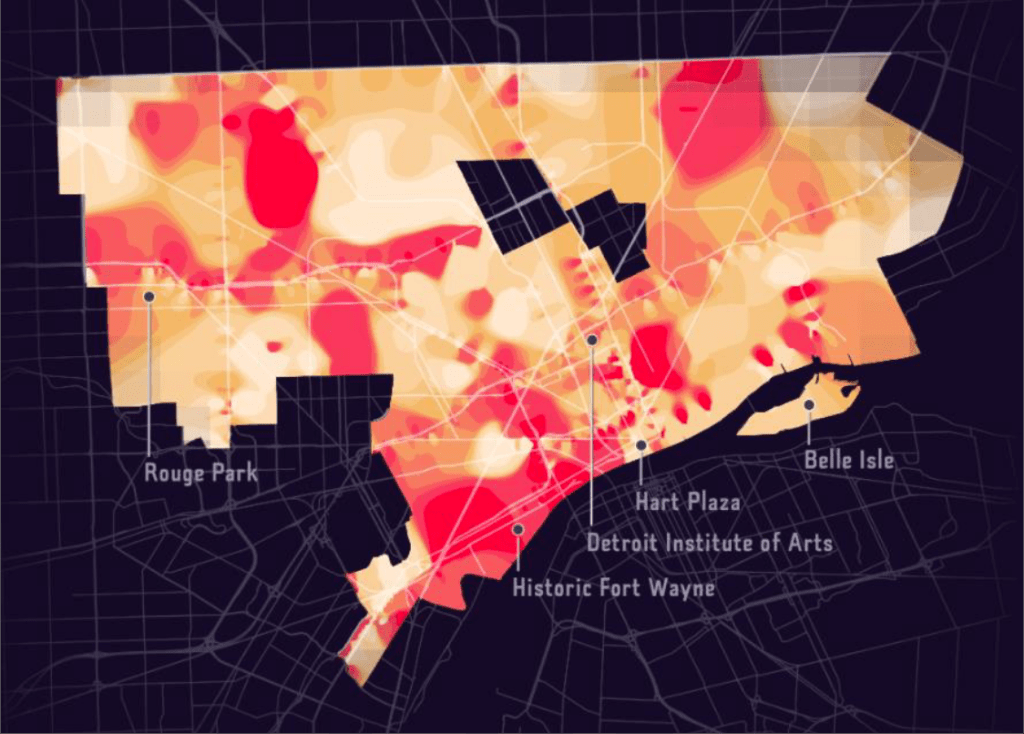
This beautiful map is part of a USDA report that includes outcomes from the Heat Watch Detroit program during summer of 2020.
The average annual temperatures of UHI areas in Detroit are 1.8°F to 5.4°F warmer than adjacent areas, ranging from 70°F to 85°F (Gregg et al., 2012 & Heat in the City, 2020). CAPA Strategies conducted a Heat Watch in Detroit, providing maps of temperature distributions throughout the city on August 8, 2020 for the morning, afternoon, and evening (Figure 1.9). This study demonstrates where in the city there are warmer and cooler pockets, which are often dependent on the qualities of the land as well as its use.
Artist William Ogg Fitzgerald drew this pictorial map in 1934 for the Chrysler Corporation.
It presents an interesting amalgamation of the breadth of the automotive industry and specifically the Chrysler plants are in red as well as historical events in Detroit and Windsor.
It’s important to take this map’s historical accuracy with a grain of salt, but it has been presented beautifully with vibrant colors.
I’m not actually sure. It was just a map that got blown up to be the backdrop at an event. I think they just found a map with “Detroit” in big letters, like it is behind me. It’s about 8ft long by 5ft tall and printed on corrugated foam board. It’s literally the centerpiece of my living room.
It’s actually three, maybe four, pieces. I gave one piece that covered the Eastside to a friend living there and another piece to friend in Southwest Detroit. I kept the piece that meant a lot to me.
Where did you find/acquire the map?
This was given to me by the Display Group. I was co-chair of American Heart Association’s charity ball and it was part of the decor. I asked what they were going to do with it after the event and they said they’d probably just throw it away. I could fit three pieces of the map in my car after the event.
What made you hang it on your wall? What stood out to you? What details do you enjoy about the map?
Where I grew up is on this map and where I lived (at that time) was on the map too. It was a sign.
And I do love maps. When I look at this map though I don’t see lines, I see memories. I see railroad tracks. I’ve been down every street on this map.
So, I founded the world’s largest weekly bike ride, called Slow Roll. I made the Slow Roll maps for 10 years. There have only been a few times when we got in trouble for what we do. In Hamtramck we caused a major issue with hundreds of people’s cars getting ticketed or broken into. The Hamtramck mayor even wrote about it after. So there is a Slow Roll sticker on the city because I say that’s the closest I’ll ever get again to Hamtramck because it’s too much work.
What in your background has drawn you to maps?
I love maps. Growing up my parents couldn’t afford for us to travel, so maps were my way to travel.
When I did the commercial with Apple, I had never traveled and that opened so many doors. After traveling more places, maps became something different to me. I never realized how important it was to travel and experience other places. It’s mandatory. If you don’t see the world then you haven’t been shaped by global theories and philosophies.
Now when i look at a map instead of admiration, its motivation to go and see that place.
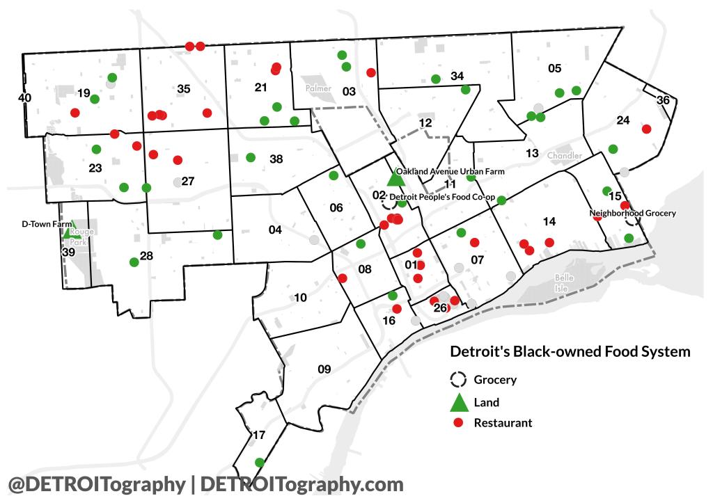
The repeated and compound impact of structural racism on Detroit’s food system couldn’t be more obvious than the need for a Black Farmer Land Fund, a Black Restaurant Week, and crowd-funding efforts for Black-owned grocery stores in the Blackest city in the US. These are just a few recent concerted efforts to change the status quo, but its important to note that this is NOT everything that is Black-owned in Detroit’s food system. The additional gray dots are food businesses catalogued by The Black Bottom Archives (add any missing businesses to their directory).
The Black Farmer Land Fund launched to address the racial disparity of land access in urban agriculture in Detroit. The cumbersome process of working with the Land Bank was limiting the number of Black participants that could access land for agricultural uses. D-Town Farm run by the Detroit Black Community Food Security Network (DBCFSN) and Oakland Avenue Urban Farm are the two best known Black-owned urban agriculture operations.
Detroit Black Restaurant Week launched in 2017 and the founder, Kwaku Osei-Bonsu, received racist diatribes and death threats. The week featuring Black restaurants is now in it’s 6th year with 30 participating restaurants. COVID-19 has hit Black-owned restaurants hard with both ima and Detroit Vegan Soul closing one of their two locations, The Block closing permanently, and others struggling to hold on.
The last Black-owned grocery store in Detroit closed in 2014. James Hooks ran Metro Foodland on Grand River Ave. right up until a Meijer Superstore became his neighbor. The financial case for opening a grocery store is tough, but trying to convince a lender to invest in a Black-owned business seems even harder. Two current Black-owned grocery store efforts are relying on memberships and crowdsourcing to finance the opening. The Detroit Food Commons and the Detroit People’s Food Co-op closed on their land deal and are moving forward. The Neighborhood Grocery has secured a small store building and nearby land to grow produce.
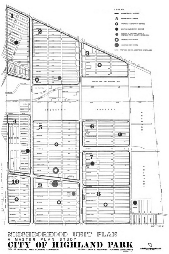
This site is usually about Detroit, but it’s impossible to disconnect understandings of Detroit from that of Highland Park (the left side of Detroit’s bow-tie).
I found this map to be interesting as I’ve considered historical divisions of neighborhoods in Detroit, but had never thought about it for Highland Park. This 1958 Master Plan Study broke the city into ten neighborhood units apart from the large industrial areas.
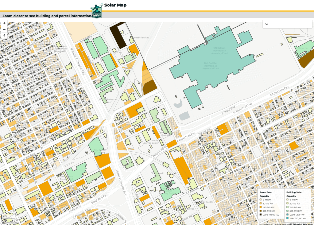
Detroit has solar potential, maybe? This map is only viewable at a very close zoom level. It seems to show that solar is most likely a possibility along commercial corridors and industrial zones. However, very few of these spots have the highest ratings for opportunity. One spot that stood out was the Detroit-Hamtramck Plant aka Poletown Plant aka Factory Zero. Good thing they have a lot of solar potential at the desired net-zero facility.
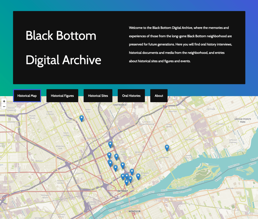
The Black Bottom Digital Archive is an outgrowth of Black Bottom Archives and the Black Bottom Street View projects. The most critical and essential element of the digital archive is its collection of oral histories from Black Bottom. A photograph archive was made to document the area before it was razed in favor of new housing developments (notably Lafayette Park), but few stories remain.
Black Bottom Archives is preserving those stories and mapping out historical sites.
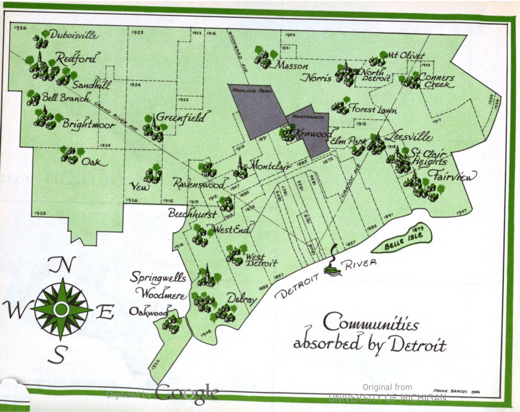
The content in this map was recreated in 2003 as a historical reference to place names in Detroit, but the original was included in the 1947 Master Plan for the City of Detroit. Many of the existing place names like St. Clair Heights, Greenfield, and Fairview are captured in street names. Others like Delray, Brightmoor, Mt. Olivet, Elm Park, and Redford live on as neighborhoods, communities, or cemeteries.
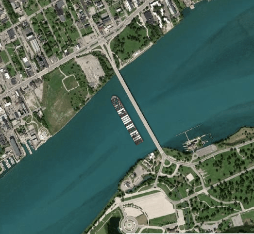
The Ever Given container ship has been stuck in the Sue Canal (sounds like it is partially free today, but not over yet) for 3 days.
Garrett Dash Nelson of the Boston Public Library’s Leventhal Map and Education Center built a quick app to place the massive container chip anywhere and everywhere. Here is the Ever Given next to the Belle Isle bridge.
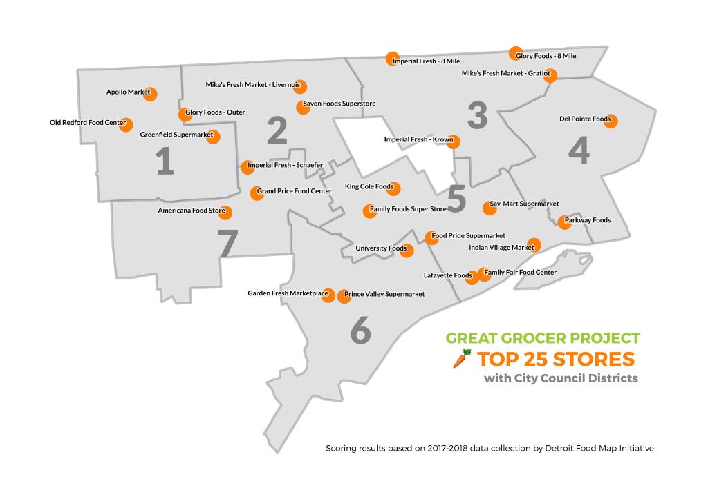
Early this month, the Detroit Food Policy Council and partners on their Detroit Grocery Coalition launched the Great Grocer Project to highlight and support improvements in Detroit’s local grocery landscape. The effort was awarded a 3-year USDA grant through partners at Wayne State University and is a culmination of nearly a decade of grocery work by the Detroit Food Map Initiative.
This map is for the top 25 independent grocery stores (excluding Meijer, Whole Foods, Save-a-Lot, and Aldi), but all 68 stores in Detroit were scored. Harper Food Center was one of the top 25 stores before it burned down in late February.
Learn more about the scoring and future efforts HERE!
In a stunning display of retail redlining, the primary corporations chosen by the State of Michigan and Federal government for COVID-19 vaccine rollout are not active or accessible across Detroit. Even those located in the city limited where they would offer vaccines with Walgreens and Rite Aid locations in Midtown clustering with no access or limited access in Detroit’s neighborhoods. CVS is only offering vaccines at 4 locations in all of Michigan with one located in Detroit.
Retail redlining and discrimination is nothing new. Door-to-door magazine sales companies practiced “bluelining” where they avoided “foreign-speaking or colored people.” The Home Owner Loan Corporation maps adapted by the Federal Housing Administration and private mortgage companies created the basis for redlining, or not approving mortgages in predominantly Black neighborhoods. Historical mapping of Green Book locations also present an important delineation of retail discrimination. Retail redlining has most often been applied to analyses of grocery and supermarket locations, which is an inequitable trend seen in metro Detroit too.
Leading up to the Great Recession, “reverse redlining” where Black homeowners in Detroit were targeted for faulty mortgage products followed by nearly no mortgages originating in Detroit. More recently there have been questions about redlining related to Pokemon Go and expanding interest in the concept as it relates to present day health outcomes.
The City of Detroit, local health system hospitals, and other partners offer a few vaccination locations outside of these specific retail locations (Walgreens, Rite Aid, CVS, Sam’s Club, Walmart). In a pandemic response supposedly driven by equity, one would assume more forethought for vaccine distribution partners in Michigan’s hardest hit city.
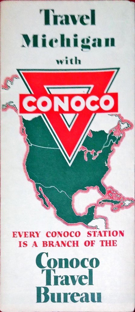
I acquired the map along with a bunch of other Conoco ones for dirt cheap at a book store in Topeka Kansas.
What made you hang it on your wall? What stood out to you? What details do you enjoy about the map?
I don’t hang this one or most of the maps on my wall due to lack of space and preservation reasons. I think the detail of the Gousha cartography firm is what stands out to me. I enjoy all the period details of the 1930s on it like Greenfield Village being labeled “Henry Ford’s Ole Time Village.”
What in your background has drawn you to maps?
I drew maps as a kid and now have geography and history degrees.
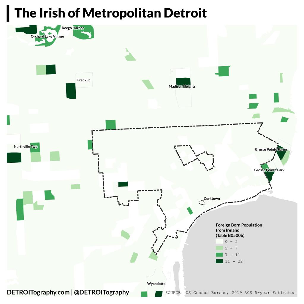
In honor of St. Patrick’s Day this week I decided to explore the Detroit region’s Irish population. This is a map only of “foreign born” people from Ireland and not those with Irish ancestry so provides a unique look at current emigration from the Emerald Isle, which is to say not many people come to metro Detroit from Ireland these days.
In Detroit, Corktown (named for County Cork in Ireland) is not the preferred landing place for Irish people, but seems further into Mexicantown and more in the Warrendale area. Metro Detroit has more Irish residents with the Grosse Pointes, Madison Heights, Farmington, Northville, and Orchard Lake highlighting.
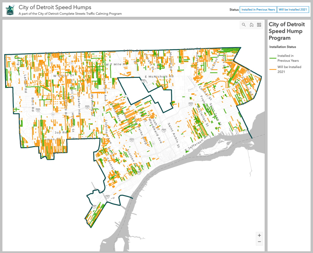
Speeding on city streets is the primary cause of Detroit’s high number of pedestrian deaths and overall roadway crashes. The City of Detroit began installing “speed humps” in 2019 and will be ramping up efforts in 2021. The most effective methods to improve roadway safety is to update the design of the roadway – in this case with speed humps.
Looking forward to seeing numbers drop for crashes and deaths in Detroit.
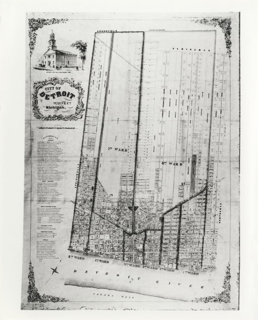
Early Detroit was divided into Wards for political and population management. These are the oldest boundaries for Wards and the lines and numbering were changed and updated.
This map had been particularly important as I worked on locating historic neighborhoods from Silas Farmer’s “The History of Detroit and Michigan.” A neighborhood called “Piety Hill” in 1884 has different boundaries than what is known in present day as “Piety Hill” near the Northend or the Registered Historic Place in Brush Park East of Woodward.
The 1853 Ward Map helped me to pinpoint the original Piety Hill in the old 5th Ward, West of Woodward and North of Grand River.
Contact
Submit a map or just get in touch. Thanks for following!