
Aaron Foley is the Director of the Black Media Initiative at the Center for Community Media and a John S. Knight Journalism Fellow at Stanford. He is the first and former Chief Storyteller for the City of Detroit and a prodigiously published writer and journalist with work at Jalopnik, Belt Publishing (3 books + multiple essays), and BLAC Magazine (former Editor in Chief).

What is your map at home (title, year, etc.)
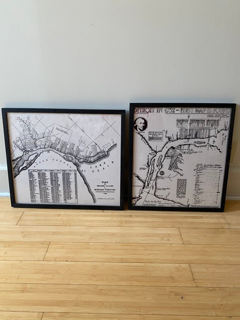
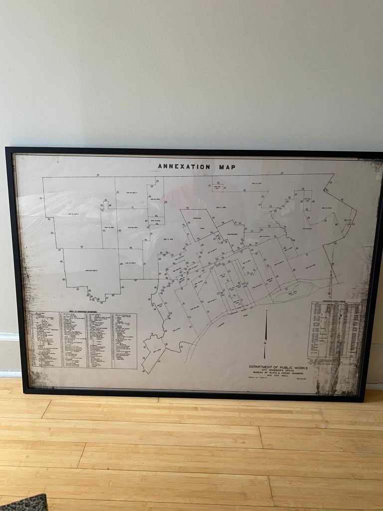
There are five maps and all of them are transparencies — I assume they were used on projectors or lightboxes at some point. One is from 1752 and purports itself as the first found map of Detroit. The second is from 1810 and is a map of ribbon farms along the shorelines of the Detroit River and Lake St. Clair. The third is a map of Wayne County from 1855. The fourth is an annexation map of Detroit from 1931. The fifth is an undated street map that highlights public land use like cemeteries and parks, but if I were to guess based on some clues, it was produced after Detroit formed its current borders in the 20s but before the Ridgemont Golf Club in East Detroit (now Eastpointe) became a residential subdivision in the 1950s.
Where did you find/acquire the map?
In 2018, the Planning and Development Department at the City of Detroit was renovating its offices and throwing a bunch of things out. I was working at the City at the time and had a meeting on their floor and scooped them out the discard pile.
What made you hang it on your wall? What stood out to you? What details do you enjoy about the map?
What stands out to me the most about each map is that each one is a record of how Detroit became Detroit. The 1752 map is mostly in French, which recalls the city’s French settlement. The map of farms has a few names that are still around today — Kirby, Rivard, St. Aubin, Campau, Beaubien. My favorite is the annexation map because each part of the city and when it was annexed is dated, and you see just how rapidly the city grew in the 1920s, particularly the west side. Then you think of the architecture of the city and how it corresponds to the dates. If you overlaid a neighborhood map on this one, you’d see neighborhoods with older housing styles, like Corktown and Woodbridge, line up with where the oldest parts of the city are dated. Same with the newer parts of the city, like where Rosedale Park is — but then you have to imagine, large swaths of the west side was rural farmland at one point. I have an image of riding a horse southeast down Grand River and seeing nothing but fields, and then boom! — you’re in a “new development” in Woodbridge in the 1910s.
I’d originally planned to hang them up in my apartment in Detroit, but life for me took some unexpected turns. I ended up doing a yearlong fellowship in California, which then segued into a job in New York. Back home, I loved having people over and entertaining and can’t wait to do that again when it’s safe, but when it is, all my guests will know where I’m from and why it’s important to me to have big reminders of that.

What in your background has drawn you to maps?
I’ve always been a Detroit history geek, and I didn’t realize it was a lifelong thing until I was going through some old papers recently and saw that I had been writing little things about Detroit neighborhoods going back to elementary school. And I’ve been a map fiend too — one of the best (or worst?) things my mother ever gave me as a kid was a world atlas she used as a kid. And now that I’m thinking about it, I used to flip through our Rand McNally road map book of Metro Detroit just for fun, and ended up memorizing a bunch of street names on all sides of town. Part of it too is just how big Detroit is, land-wise, and how much you can still learn about the city, even if you’ve lived there your whole life.

Hi Alex,Do you know if a map of Detroit’s Roman Catholic parishes exists? I’m interested it is possible to find a sequence of them for a series of years during the 20th century. Thanks Carl Trocki
Sent from Yahoo Mail on Android