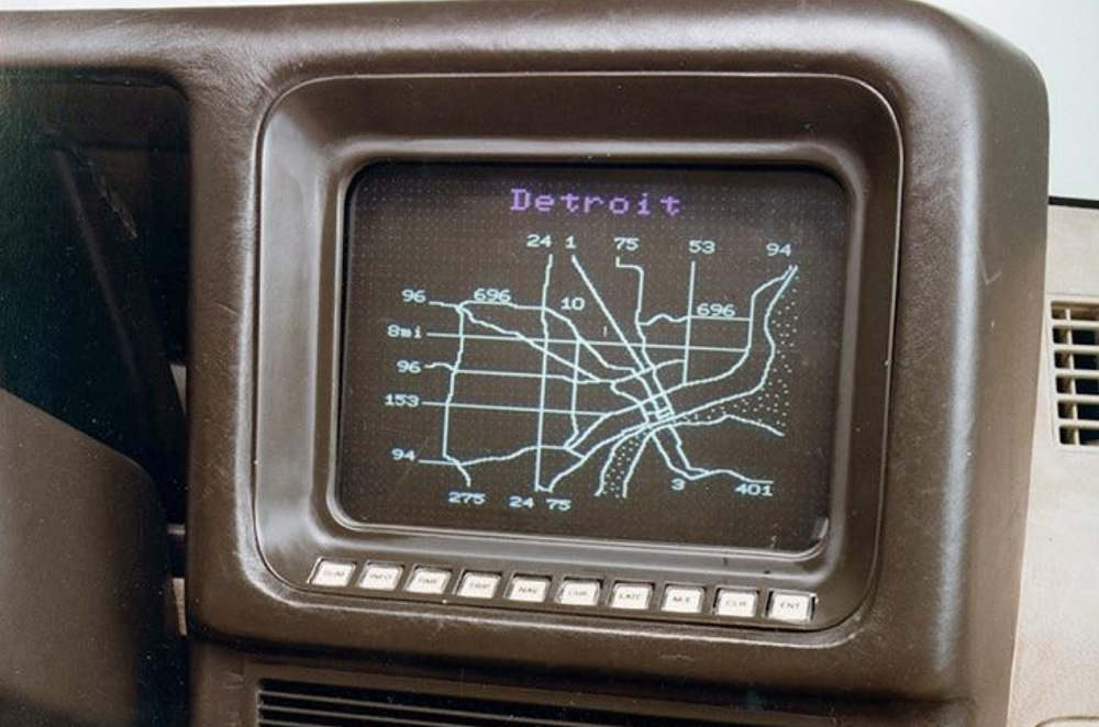
This wonderful digital map was the first implementation of GPS tracking for cars that then plotted a vehicle based on its latitude and longitude. The Ford Motor Company engineer, Mark Jarvis noted that it was accurate within 400 meters (metric?).
A commentor on reddit noted that I-696 is disconnected in 1983 because the Suburbs were still arguing over the route it would take.
The Tripmonitor was before its time, but has aided Ford in advancing this GPS car console technology.
Read more on the Tripmonitor:
Tripmonitor utilized a magnetic compass and a series of sensors to determine the car’s location. Once calibration was completed, software was used to compensate for the vehicle’s magnetic properties in regards to compass readings. There were obvious issues with using a magnetic compass, however. Mainly because there’s just no reliable way to filter out the effects of things like nearby transformers on GPS systems.
