
by: Paul Jones III
Belle Isle is undoubtedly Detroit’s most beloved park. The city’s island getaway is regularly flooded with people on warm days, and welcomed 5.2 million visitors to its beaches, picnic groves, and lakesides last year alone. Detroiters love Belle Isle and have for generations. It has played a significant role in the city’s history since its development in the 1880s. More personally, Detroiters have made childhood memories, gone on dates, proposed, held birthday parties, family reunions, and intimate gatherings with families and friends in the park. This underscores the significance Belle Isle holds in the minds of Detroiters and highlights how important it is to maintain it as a world-class, functional public space. While the island is a place of respite, relaxation, and enjoyment for Detroiters, it is also obvious that the park experience continues to be degraded by disinvestment, mismanagement, and environmental neglect that have characterized decision making for decades.
With the disruptive use of the Island for the annual Grand Prix coming to an end, new grant dollars coming from the U.S. Department of Interior, and more opportunities, a number of changes are poised to take place. This should be an exciting time for Detroiters to imagine a park that more accurately reflects the special place Belle Isle is. By sharing this vision, I hope to inspire those who care about Belle Isle and public space in Detroit to challenge themselves to imagine the brightest future possible for the places we love so much. This vision is a compilation of ideas for Belle Isle that have been gleaned from historical documents, some unbuilt proposals, and elements of my own. Below, the new park is observed from the perspective of someone riding the new shuttle loop.

STOP 0: Belle Isle Transit
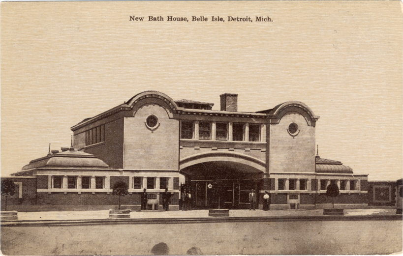
Visitors to the improved park are greeted by a new monumental ‘Belle Isle Park’ sign and entry plaza at Jefferson and Grand Boulevard. Because it’s a busy weekend day, people driving are directed to park in a structure located at the former uniroyal site and use the Belle Isle Transit Center to access the island. This center’s design is a nod to the original Belle Isle tram stop that was demolished in 1980 and gives visitors access to bike share, bike rentals, and wagon rentals for hauling outdoor gear without a car. Most importantly, it is Stop 0 on the Sunset and Sunrise shuttle loops that give car-free access to all the park’s destinations. Visitors board the shuttles here and are whisked across the bridge to the island.

STOP 1: Remick Amphitheater
A roundabout at the approach now enables park goers to travel both directions on the park drive. Stop 1 is just east of the park drive’s intersection with the bridge. This stop gives visitors access to the Remick Amphitheater, and the Detroit Boat Club on the other side of the park drive. The bandshell has been relocated from its site on Loiter Way, and is now complemented by seating and a lawn that gives spectators sweeping stage views against the backdrop of the Detroit skyline. The northernmost portion of the park’s picnic grove surrounds the amphitheater and has 5 shelters in various sizes.
/cdn.vox-cdn.com/uploads/chorus_image/image/65497640/Remick_3.0.jpg)
STOP 2: Central Ave
At the intersection with Inselruhe, the shuttle loops diverge with the Sunset loop turning to service the western part of the island and the Sunrise loop continuing east. The Sunset loop goes on to Stop 2, called Central Quad for its position on the Island. Just past the restored pedestrian promenade at Central Avenue, visitors use this stop to get to the Inselruhe pier that looks over the beach and Detroit River, the Belle Isle History Museum occupying the old Belle Isle Police Station, the Kid’s Row play area, giant slide, and new dog park. The comfort station at Central & Inselruhe has been restored to service the northeast section of the picnic grove with 3 shelters. The centerpiece of the quad is a pedestrian plaza that surrounds the restored equestrian monument honoring Union General Alpheus Williams. Kid’s Row provides unique play experiences for the park’s youngest guests and thoughtful accommodations for entire families. The Sunset loop continues forward, turning right at the portion of park drive formerly signed as Loiter Way.


STOP 3: Inselruhe Cultural Center
Occupying the structure originally built as coach stop 7, stop 3 is a key station that services the Inselruhe Cultural Center, a collection of historic and newly built institutions and gardens celebrating Detroit’s cultural and natural heritage in one place. The Aquarium and Dossin Museum still anchor the eastern end of the center while the newly formed Belle Isle Botanical Gardens encompasses the Conservatory and Nancy Brown Peace Carillon. A new conservatory has been built south of the gardens surrounding Marshall Frederick’s Barbour Fountain, a Japanese lake garden now stands between the Picnic Way bridge and Carillon, and a Children’s garden complements the Oudolf Garden. The Botanical Gardens’ Conifer Collection provides a year-round green oasis for park visitors and leads to the Flynn Pavilion further west. Another new addition to the Cultural Center is the Belle Isle Arts Gallery next to the Dossin Museum, a unique riverfront gallery space on the island.
On the other side of Inselruhe, Greenhouses provide space for Detroiters to learn about local horticulture and the historic horse stables have been repurposed to house a craft center. Inside, groups and individuals can take on Belle Isle inspired arts and crafts projects while a weekly open air crafts and vintage market happens outside. Belle Isle’s historic Sawmill and the White House on Inselruhe that predates the park are also serviced by this station.
STOP 4: Lake Tacoma
Lake Tacoma is located near Stop 4 and gives this station its name. This area is anchored by the Flynn Pavilion which offers a snack bar, pedal boat rental, and pontoon tours of the park’s canals in the summer and is the center of winter activities for the park. This portion of Lake Tacoma is lowered and frozen in the winter to offer ice skating and is complemented by the park’s holiday tree on the Muse Rd pedestrian mall. A sledding hill with spectacular views of the park and city rises just in front of Flynn Pavilion where there used to be a parking lot. The main picnic grove is just across the park drive.
STOP 5: Fountain Way
Moving along, the shuttle approaches Stop 5 at Fountain Way. This gives riders access to the iconic Scott Memorial Fountain and the surrounding esplanades of maple, oak, and bright cherry blossoms. Many of these were donated from Detroit’s Japanese sister city Toyota. Using this stop, visitors can also head to the Belle Isle Casino for special events or catch concerts, plays, and other shows year round at the new Fine Arts Theater. New walkways, canal connections, and bridges have transformed this portion of the park and offer a more fitting centerpiece of Belle Isle’s west end. These enhancements are loosely based on Cass Gilbert’s 1917 drawings for the Scott Fountain and surrounding grounds.

STOP 6: Sunset Point
Sunset Point is Stop 6 on the sunset loop. Once adorned with simple pathways and scattered benches, this area is now a cohesive, monumental space celebrating Detroit’s beautiful sunsets. The centerpiece of this destination is the sunset rotunda which rises behind a small lagoon where a simple brick comfort station once stood. The rotunda is flanked on either side by a comfort station and a bistro that are connected by a colonnade. These are popular destinations for evening walks and have patios where Detroiters can sit and socialize freely. From this complex, a pedestrian walk continues towards the river and connects visitors to the park’s new observation tower. Here, park goers can climb to 100 feet by stair or elevator for a panoramic view of Detroit’s International Riverfront.
STOP 7: Welcome Center
Stop 7 is home to the Welcome Center and Grand Lawn. After the demolition of the Grand Prix paddock, the Grand Lawn was built as a reinforced natural grass landscape optimized for large events and heavy foot traffic. The Casino overlooks the lawn from the south and the Welcome Center mirrors the Casino’s architectural style in a smaller, modern format on the north side. At the welcome center, visitors can get information about attractions and events in the park, find groups to walk or exercise with, sign up for tours, and shop at the Island’s souvenir shop. Behind the Welcome Center on the banks of the Loop Canal is the park’s main canoe and kayak rental shelter. The location near the beginning of the canal system facilitates more full enjoyment of the park’s waterways. The main offices of the park are located on the small peninsula created by the Loop Canal and Detroit River. From here, the shuttle’s sunset loop will cross the MacArthur bridge to return to the Belle Isle Transit Center at Jefferson.
To reach the eastern end of the island by shuttle, park goers should use the Sunrise Loop. Instead of turning right at Inselruhe after Stop 1, the Sunrise Loop Continues forward to service stops 8-14 before rejoining the Sunset Loop at Stop 3.

STOP 8: Riverbank Beach
Stop 8 is home to Riverbank Beach and its accompanying beach house, pools, and boardwalk. The windowless beach house that once served the beach has been replaced with a larger facility that offers locker rooms and showers for the beach area as well as an indoor/ outdoor pool deck that can be used year round. This deck is flanked by risers that allow space for sunbathing and relaxation or spectating during competitive events.
The Oakway Comfort station provides support facilities on the other side of the park drive and invites people from this stop and the beach to explore the Belle Isle Flatwoods.
STOP 9: Lake Muskoday
Stop 9 is at the western tip of Lake Muskoday and entrance to the Detroit Yacht Club. This stop gives visitors access to the boat launch at Lake Muskoday, the eastern end of the beach and a trailhead for the Belle Isle Flatwoods.
STOP 10: Muskoday East
Stop 10 is on the eastern shore of Lake Muskoday. Here, park goers can access a comfort station, the fishing area at the Detroit River, as well as exhibitions for the two water intake cribs at Belle Isle and the razed Waterworks Park that once existed sat across the river. As part of long-term initiatives to improve the system of waterways on Belle Isle, Lake Muskoday’s connection to the Detroit River has been restored as well as a part of the lake that was once filled in north of the park drive.
STOP 11: Blue Heron Lagoon
The view of Blue Heron Lagoon opens up to the left, and is Stop 11’s namesake. The new overnight campground on the shores of Lake Muskoday is reached from this stop. Just south of Camp Muskoday, efforts to protect and restore the park’s tree cover are aided by a full-service permaculture center and tree nursery at the former site of the nature zoo on the eastern end of the forest. Here, Belle Isle trees are propagated, raised, and studied to enhance and protect the park’s ecosystem for future generations. Blue Heron Lodge, which offers a cafe, accommodations for swimming nearby, and event space, now occupies the site of the relocated golf range. A beach has been built on the northern shore of Blue Heron Lagoon, and sand paths lead to other swimming areas along Hippie Channel.
STOP 12: Lighthouse Point
Next up, shuttle riders are taken to Lighthouse Point, Stop 12. A new comfort station complements the Iron-Belle Trailhead, a parking grove, and 2 picnic shelters can also be found here. Continuing towards the lighthouse, visitors will now find rolling meadows of native shrubs, flowers, and grasses which add dynamic color and depth to this section of the park and create bright pathways towards the Livingstone Lighthouse. Beyond the lighthouse, the grove of trees and shoreline overlooking Lake St. Clair offers the best place in the park to greet the morning sun. Here, fitness and meditative meetups happen and give space for the city’s early risers to build community.
STOP 13: The Strand
Stop 13 gives visitors access to the area of the park known as The Strand. A portion of the southern beach shoreline has been restored, and beach goers can access showers, restrooms, and other amenities at The Strand Beach House. The park’s southern fishing pier is also accessible from this stop. From the beach and fishing pier, visitors can cross the park drive to walk the Lake Okanaka shore and islands on a raised boardwalk that connects this area to the Flatwoods and Iron-Belle trailhead. On this side, the
Woodside comfort station has been restored and offers services and amenities at the southern entrance of the woodlands.

STOP 14: Athletic Park
Stop 14 houses the Belle Isle Athletic Park and the park’s historic Wet-Mesic Flatwoods. The historic Athletic Shelter, originally built in 1898 as a bicycle pavilion, now houses a museum celebrating the history of bikes in Detroit and event spaces for the athletic park. The athletic park includes a set of basketball courts, a multi-purpose stadium that can house a range of competitive activities, 2 baseball fields, and a connected indoor field house and fitness center. This complex has a number of practice fields that can be reserved or used for pick up play. Near the riverfront is the park’s golf range in a smaller footprint than its former site on Blue Heron Lagoon. Closer to Inselruhe, 3 large picnic shelters support team gatherings near the athletic park. Tennis courts have been moved further south and two sand volleyball courts stand between the athletic park and The Strand Beach.
The woodlands at the center of Belle Isle have been extended to occupy their historic footprint, and A new nature center for the flatwoods now stands in a clearing that used to be the site of the park’s handball courts welcoming park goers into the woodlands. To facilitate the restoration of the park’s wetland forest, most paths are on raised boardwalks that allow water to flow freely beneath. Highlights of the flatwoods are demonstrations of the impact of Emerald Ash Borer and Oak Wilt on Detroit’s trees, the performance of the wetland forests during flooding, and the unique ecosystem found in the park and Detroit River. A large arch has been built at Central Avenue’s entrance to the flatwoods, and an adventure park with canopy walks, high ropes, climbing and other activities occupies the woodlands where the children’s zoo once sat.
After Stop 14, the Sunrise loop rejoins the Sunset loop to service stations 3-7 and head back to the Belle Isle Transit Center.
Paul Jones III (@PaulTheUrbanist) is a native Detroiter and recent graduate of the University of Michigan Master in Urban and Regional Planning program. Paul is passionate about the intersection of history, urbanism, and social justice in Detroit and is interested in empowering communities with a working understanding of how the built environment impacts daily life.

Where is the Belle Isle Nature Center???
It’s on the eastern end of the island across from the new playground at intersection of Oakway/Lakeside Dr across from the golf driving range. Hamilton Anderson has a wonderful plan for the whole island. The draft was made 1995-2005 (Master Plan for Belle Isle). It is wonderful….check it out. Also the New York firm Biederman Redevelopment Ventures made a draft plan for Belle Isle back in 2015. It is also very wonderful. These plans are full of very creative new things for Belle Isle.
Belle Isle is a gem of the nation (not just Detroit). Investment should be a priority. A new beach house and waterpark is a no brainer. A real 9 hole golf course should be rebuilt. Small campgrounds should be established. Hayrides and pony rides should be reimplemented. A remodeled amphitheater for small concerts. RC boat and drone area should be established. More kite shows, bike shows etc. Please establish quality/consistent food vendor options that are spaced throughout the island. Invest in a athletic dome for baseball/softball, lacrosse and soccer! The outdoor baseball field can be really nice with investment.
Love the idea
Love Belle Isle. I want and wish nothing but the BEST for the park
I love almost all of your ideas! I just wish we could bring the ‘animal experience’ back to the park. At one time, you could horse back ride along trails, they had horse-drawn carriages and pony-carts, and of course, the zoo. Bring back some aspect of that experience with animals. Also, I love the idea of adding a Botanical Garden in the vicinity of the Carillon, but why do you propose building a new conservatory? That doesn’t make sense.