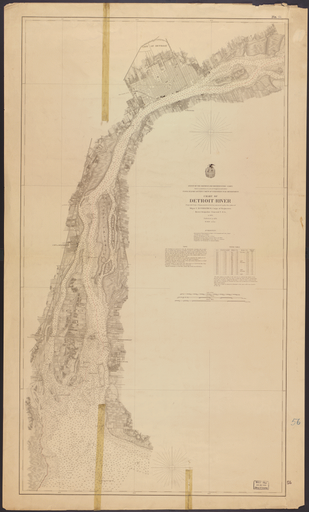
This map from the Library of Congress adorns the wall of the exhibition hall at the Dossin Great Lakes Museum on Belle Isle. I recently visited the museum for the first time with my son and just could not place this map from the wall. Typically I like to say that Windsor has been holding Detroit’s map legend since 1876, but that was not the case on this map. Windsor was labeled and the shoreline was fully populated. Thankfully, Emily Kutil recommended the US Lake Survey and there it was. The lake survey needed to map both sides of the river where locally we usually leave off our dear Canadian neighbors to the South.
Fun history bits on the map include the marshiness of the Grand Marais, the funky shape of Belle Isle before the ends were filled in to create Sunset Point, the well-defined Grand Trunk rail line encircling the city limits, and the demarcated farmland along the edges of the city. I personally adore the compass roses on this map.
Here’s to a pleasant map surprise on a random summer weekday!
