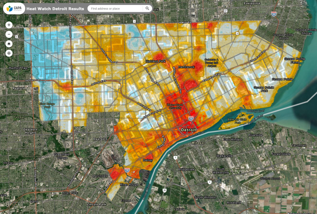
This past summer on August 8th, the City of Detroit, EcoWorks Detroit, and the Youth Energy Squad, and in partnership with CAPA Strategies and the National Integrated Heat Health Information System (NIHHIS) conducted a community heat watch data collection via vehicle and bicycle (in Palmer Park and on Belle Isle). The resulting maps show the traverse points and temperature models for Morning, Afternoon, and Evening.
View the interactive map HERE

Pingback: Map: Detroit Urban Heat Islands 2020 | DETROITography
Pingback: Map: Tree Equity in Detroit | DETROITography