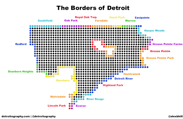
Detroit is bordered by 20 municipalities and 1 river. The Detroit River has the longest border with the city followed by the City of Dearborn. I thought this would be an interesting way to visualize the different borders inside and outside the city without being technical and geospatial.
Edited 11/11/13: Eastpointe and Grosse Pointe added bringing total to 20 municipalities, “Twp.” added to Royal Oak

What about Eastpointe?
Thanks for comments, Eastpointe and Grosse Pointe added. There were so many to keep track of I lost a few.
This is cool. Thanks
What streets make up Detroit’s borders? Probably quite a few.
Technically GP Woods also borders Detroit along St. John Hospital and Kingsville St.
I loved this. It helped me. Thanks!