Mental Maps of Detroit 1978

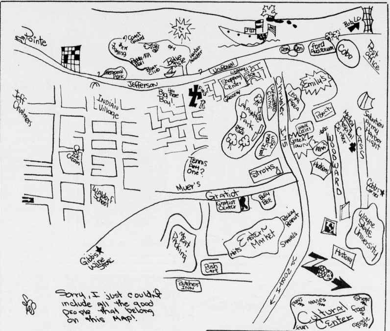
In 1978, the Detroit Free Press asked area residents to: “Draw a map of Detroit and include anything meaningful.”

“People see Detroit in strikingly different ways. The few blocks surrounding the house in which they live, a hodge-podge of restaurants, a bunch of freeways leading to suburban townships, some streets and buildings downtown.” – Tom Fox (May 6, 1978)

Susan Slameka, Lafayette Park
Jan Reed, Rochester
Jonathon McClinton, Greenfield (Westside)
Diane Schubot, Harrison Township
Kenneth Hughes, 30 (Downtown)
Theodore Bass, 17 (Eastside)

Leave a Reply

Fill in your details below or click an icon to log in:

WordPress.com Logo

You are commenting using your WordPress.com account. Log Out /  Change )

Twitter picture

You are commenting using your Twitter account. Log Out /  Change )

Facebook photo

You are commenting using your Facebook account. Log Out /  Change )

Connecting to %s