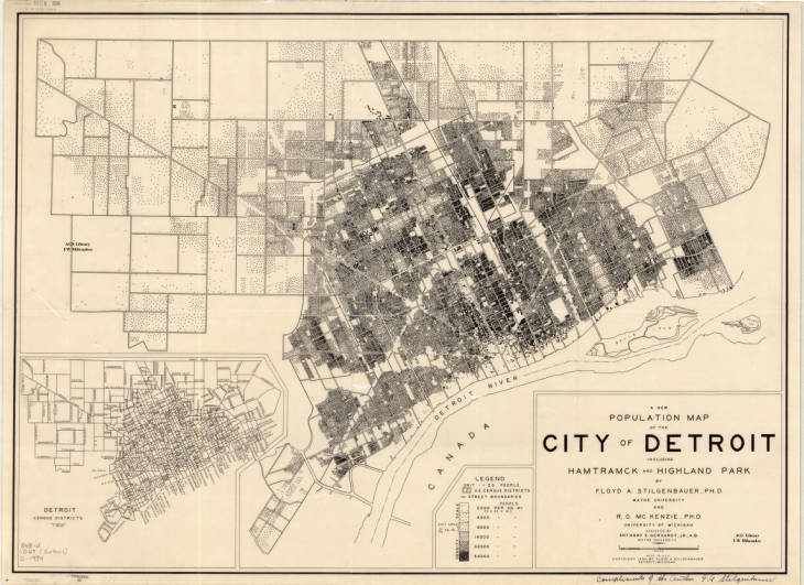
The GIS and Cartography Lab in State Hall at Wayne State University is named for Floyd A. Stilgenbauer. He was a professor of geography and a pioneering cartographer in his time. He is credited with advancing proportional symbology with the likes of Erwin Raisz as well as led the Air Cargo Research efforts to plan for the advancement of shipping via airplanes rather than boats.
This map comes from the collection at the American Geographical Society Library at the University of Wisconsin – Milwaukee.
A New population map of the City of Detroit including Hamtramck and Highland Park / by Floyd A. Stilgenbauer ; R. D. McKenzie ; assisted by Anthony E. Gerhardt
