This map comes from the Detroit Public Library Digital Collections.
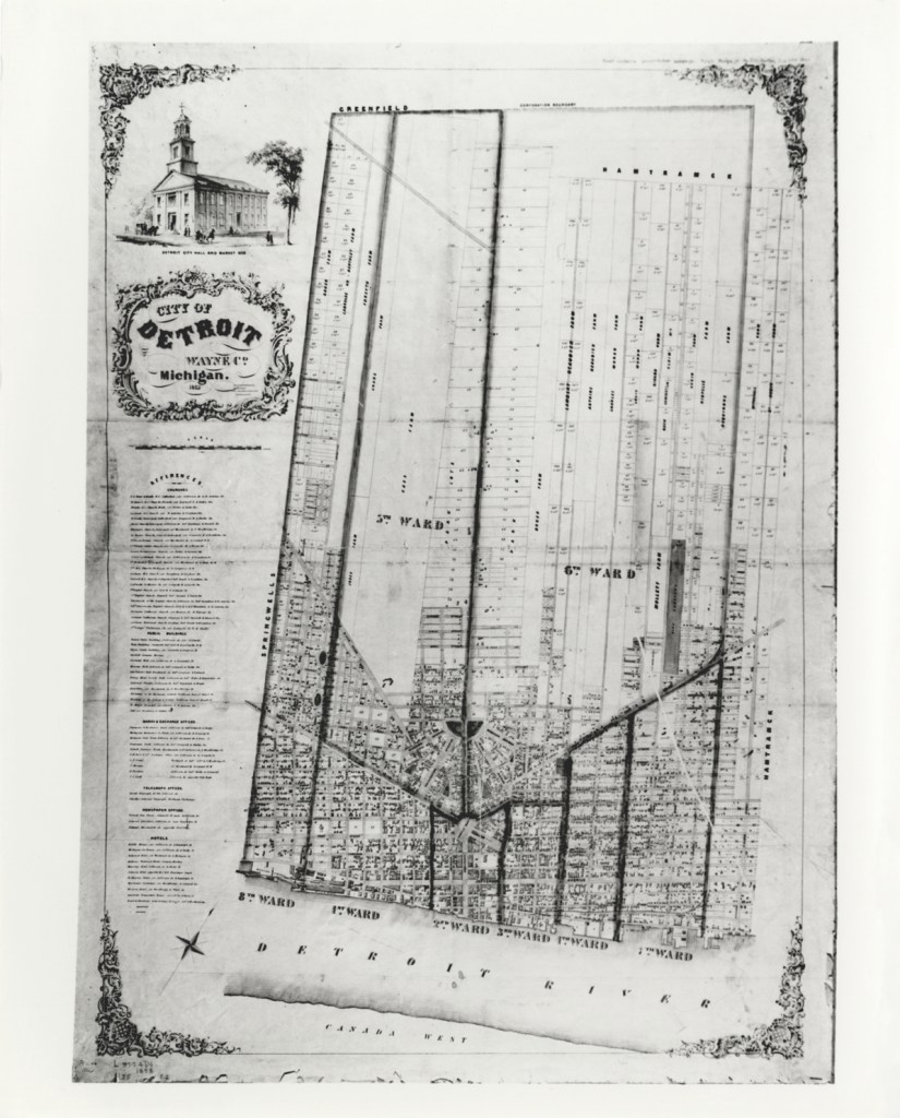
Early Detroit was divided into Wards for political and population management. These are the oldest boundaries for Wards and the lines and numbering were changed and updated.
This map had been particularly important as I worked on locating historic neighborhoods from Silas Farmer’s “The History of Detroit and Michigan.” A neighborhood called “Piety Hill” in 1884 has different boundaries than what is known in present day as “Piety Hill” near the Northend or the Registered Historic Place in Brush Park East of Woodward.
The 1853 Ward Map helped me to pinpoint the original Piety Hill in the old 5th Ward, West of Woodward and North of Grand River.
