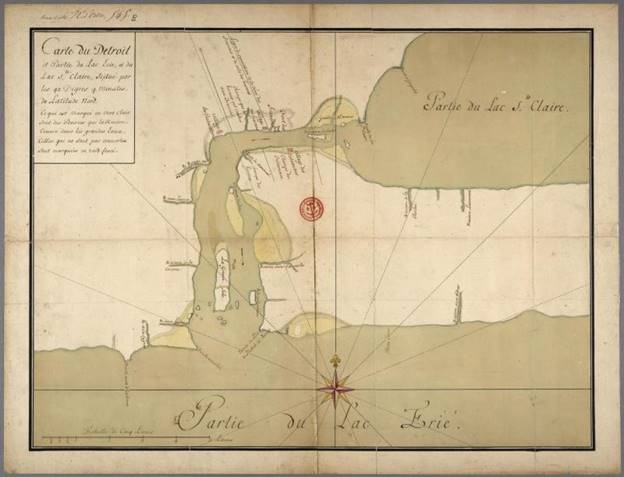
This map caught my eye because I had never seen it before. The French-Canadian Heritage Society of Michigan shared the map courtesy of the Bibliothèque et Archives Canada / Library and Archives of Canada, but the link is broken now.
I’ve posted just one other map from 1731 and this might be a copy of that map. Gaspard-Joseph Chaussegros de Léry was King Louis XV’s Chief Engineer of New France. He made many maps of the territory that included Detroit as a key military, trade, and transportation location. His other work included the Plan of Detroit (1749) among others.
This map is a copy, which was very common practice, of Henri-Louis Deschamps de Boishebert. de Boishebert was a military leader and commander during the French and Indian War across the territory of New France. He also created one of the very first maps of French ribbon farms in 1731.
