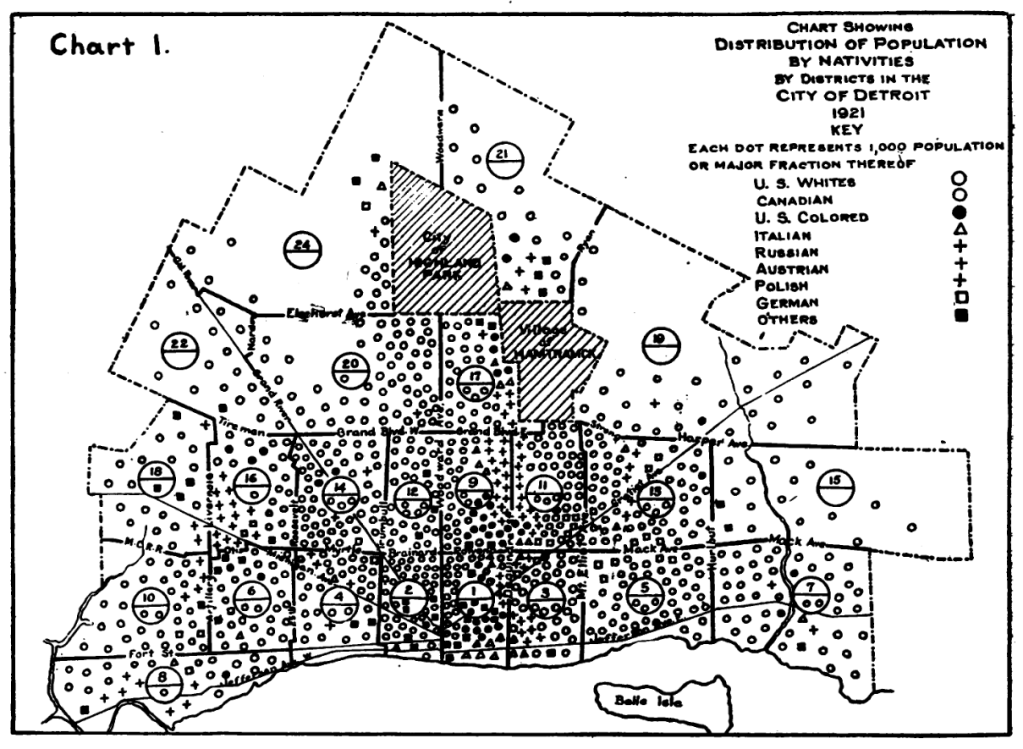
This map was included among many in a journal article published in the American Journal of Public Health by then Department of Health Deputy Health Commissioner, Watson Frank Walker. The article was focused on the relation between health and the environment. At the time the city was in its early growth:
“The city is 79 square miles in area and completely surrounds two municipalities, totaling nearly 100,000 people. It lies along the Detroit River, and is divided almost equally by its principal thorough-fare, Woodward Avenue. The older portion of the city developed around the intersection of Woodward Avenue and the river as a center. The growth has been semi-circular in nature and almost equal in all directions, forming concentric areas of new territories.”
I always find maps of nativity, or place of birth, to be fascinating as Detroit was and is a city of immigrants. Many different groups have made their path through Detroit and into present day suburbs of Detroit. Black Bottom very clearly shows the restricted density of African Americans in city. Polish, Russian, and Austrian-born residents are all coded with the same symbol, but also show a clear grouping near south of Hamtramck.
