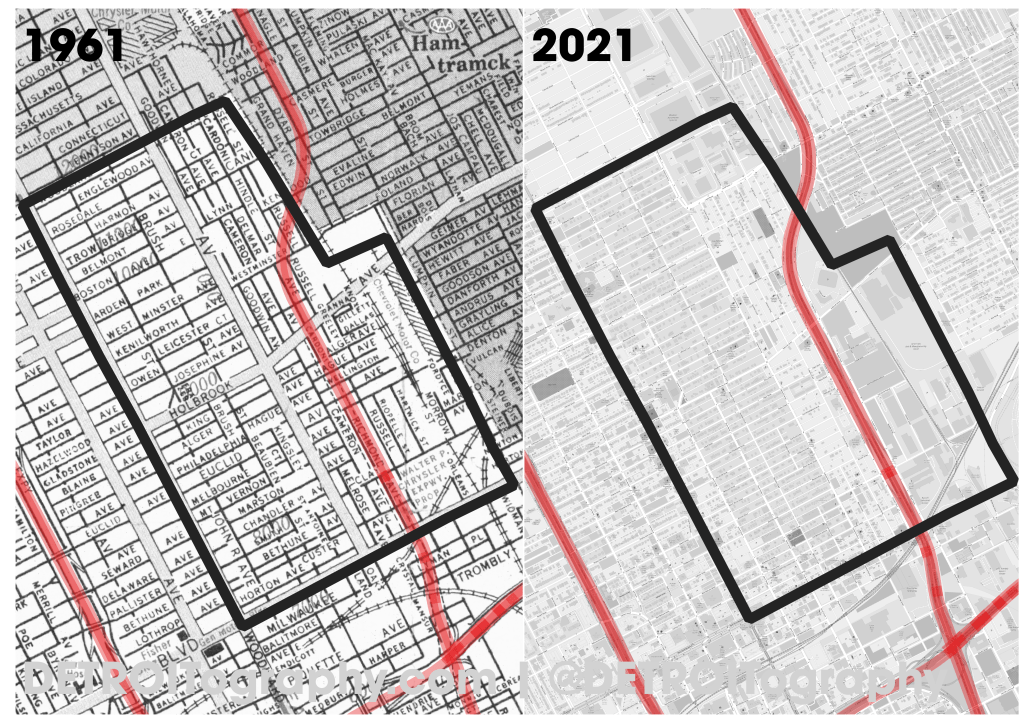
Interstate 75 cut through the eastern side of the North End. Construction began in 1959 and the historic map on the left from 1961 includes a dashed line where the future expressway was going to be built along what was Richmond Ave. The construction of an expressway is hardly a single line on a map however and the present day map on the right demonstrates the amount of destruction required to install an expressway with multiple blocks on either side removed.
This comparison map was made for the Eastern Market After Dark effort for the “North End Pavilion” to honor and support the works and stories of Detroit’s North End Community. Design Core Detroit partnered with Philip Simpson, Donna Jackson, Bryce Detroit, Reshounn Foster, LaDonna Little, the Underground Music Academy and more on the curation of the North End Pavilion.
NOTE: These maps include a boundary of the North End as defined by the project participants.

I love these “before and after” maps. Is there a higher resolution version available so we can see the lost streets better?