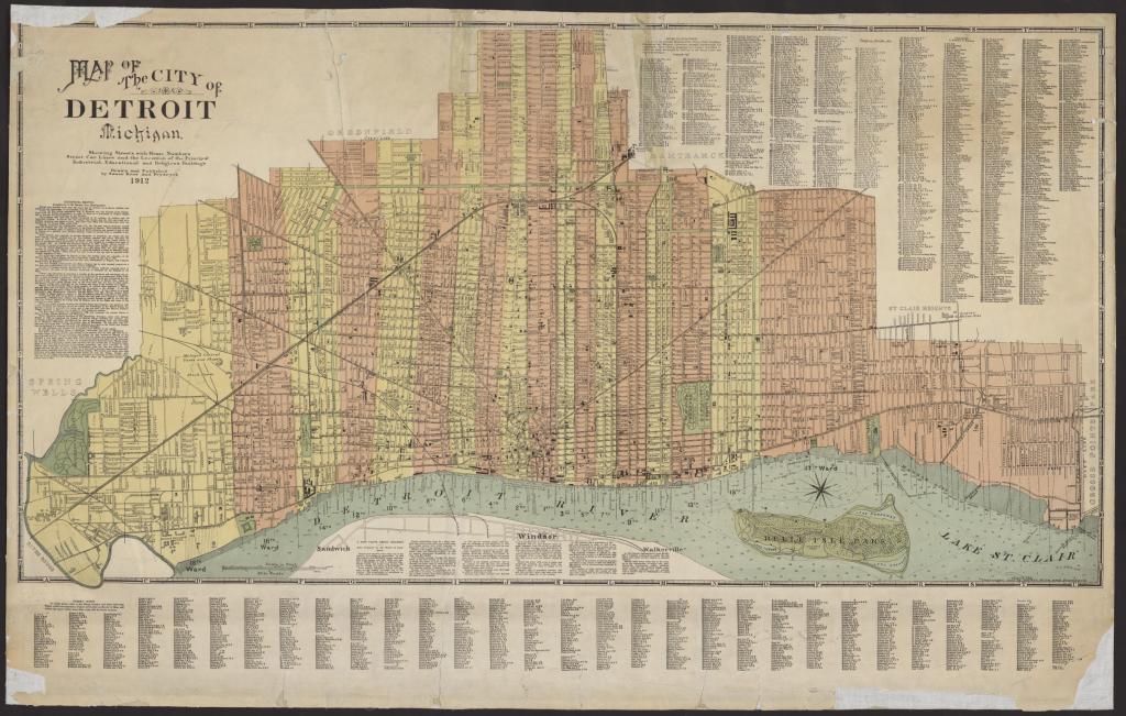
In searching for maps about street numbering, I came across this interesting map from the UM Clark Library. It’s a historical map that I hadn’t seen before and it reminded me that most old maps focused on displaying street numbers and indexes so that people could find locations and navigate the city.
There aren’t many maps from 1912 (here’s another on children’s recreation) when Detroit was quite an odd shape after stabilizing from earlier annexation activity in the early 1900s. I particularly enjoy the color scheme that is used to denote the different Wards of the city.

Pingback: 17210 Hull Street: Good Water, Cement Sidewalks (2) – Graveyard Snoop