Once described as “delightfully pointless” to map, the patterns and variations of street numbering across US and international cities continues to spark curiosity. Examples range from numbering systems by street in Berlin, Germany, to city-county numbering in Hamilton County, OH, and even typographic font choice in Arlington, VA. Lots of fun maps exist, but all house numbering has to do with taxation.
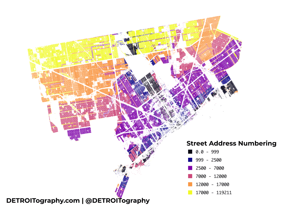
In Detroit, all streets were renumbered in 1920. Effective on January 1, 1921 the numbering scheme that is used today in Detroit remains, however you can still see the remnants of Detroit’s past urban planning and development efforts. The historic city center and areas along the riverfront retain the lowest numbers along with the oldest streets that run North-South. Detroit annexation expanded the land area of the city as well as the dominance of East-West streets. Much of the purple falls below Harper Avenue while everything in yellow is above McNichols/Six Mile.


Pingback: Map: Detroit Streets with House Numbers 1912 | DETROITography