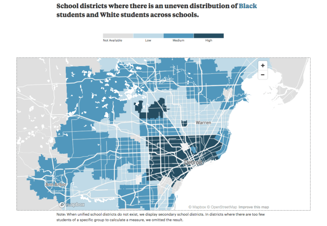
This map from the ProPublica “Miseducation” project stood out to me because the donut rings of the past have been recreated with inner ring regional suburbs having low segregation as African American residents have left Detroit for different school districts. Yet the next ring shows where school and likely community integration have slowed or stopped (i.e. Birmingham).
