by: Mark Jones
In Alan Mallach’s book The Divided City: Poverty and Prosperity in Urban America (2018) three features of neighborhood revitalization are described, one being intact urban fabric:
“Houses, small apartment buildings, and storefronts woven together create the built environment and revitalization will occur in areas where these are still standing and not where demolitions have occurred. Demolitions erode the urban fabric and ultimately discourage investment. These mixed-use, walkable neighborhoods were generally built before World War II, before cities were redesigned for the automobile”
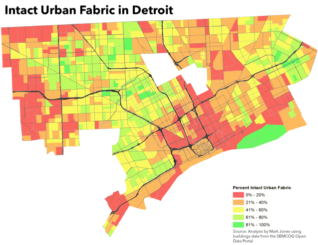
In a paper published in the Michigan Journal of Business, I attempted to define and map the percent of intact urban fabric in each neighborhood. The SEMCOG Open Data Portal contains building footprints along with the building type and year built. All buildings, except accessory buildings, built 1940 or earlier were utilized. Each building footprint was assigned to a parcel and the percent of parcels containing a pre-WWII building was calculated. The results are in the map above.

Pingback: A Bolder Vision of Highway Removal for Detroit | DETROITography