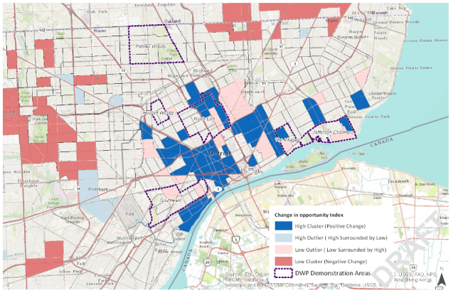
The Kirwan Institute at Ohio State University (OSU) has been developing an “opportunity index” for a number of years. In a 2014 presentation to the Kresge Foundation they conducted an analysis of the change in opportunity between 2000 and 2010 for “neighborhoods” (census tracts) in Detroit. There are a number of areas with positive change, but they are very concentrated in Greater Downtown with more absolute negative change focused in outer neighborhoods.

Pingback: Map: Opportunity Atlas in Detroit | DETROITography
Pingback: Map: Where are People vs. Jobs in Detroit? | DETROITography