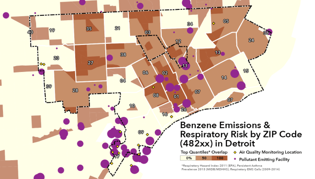
Air quality is extremely difficult to capture due to changing wind direction (generally moving from SW to NE), temperature change, size of the Detroit-Windsor airshed, and various other factors. Measuring air quality at a neighborhood level is next to impossible without an extensive network of instruments to collect data in a small area.
A handful of data sources can be helpful in examining the issue, but still lack the necessary specificity. This is highlighted in Southwest Detroit where persistent asthma, emergency calls, and respiratory risk are all categorized as low even while there is such a high density of pollution emitting facilities.
Many anecdotal accounts of teachers keeping a drawer full of inhalers and inhalers being sold for cash on the street all indicate that respiratory risk is higher in Southwest Detroit than the data show, but people are likely not utilizing emergency and other health services.

Reblogged this on Alex B. Hill.