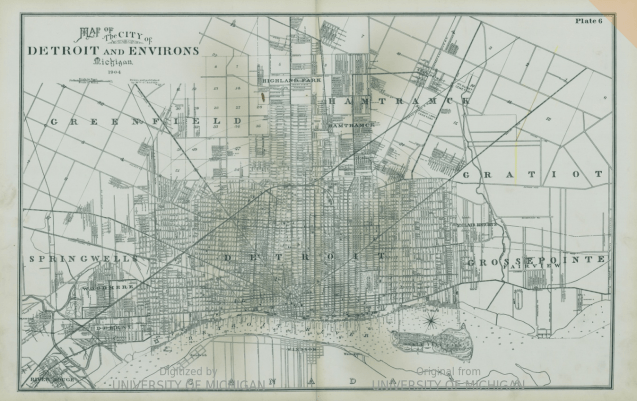
This map is from the “Detailed official atlas of Wayne County, Michigan” from 1904 “compiled and drawn from Authentic records and private surveys by W.C. Sauer, C.E.
If you happened to live East of Conner Street in 1904, you were a Grosse Pointer.
This map is from the “Detailed official atlas of Wayne County, Michigan” from 1904 “compiled and drawn from Authentic records and private surveys by W.C. Sauer, C.E.
If you happened to live East of Conner Street in 1904, you were a Grosse Pointer.

I love the history the maps display. Is it possible I can get copies of the maps?
Sent from Yahoo Mail on Android
I bought a print of this map a number of years ago at the now-closed Detroit Mercantile Co. in Eastern Market.
And technically you wouldn’t be a Grosse Pointer… You’d live in Fairview! It wasn’t until 1907 that Fairview was incorporated and split between Detroit and Grosse Pointe (becoming the Park).