This map accompanied a series of reports by Good Jobs First and highlight the on-going challenges of metro Detroit industry, job access, and opportunity.
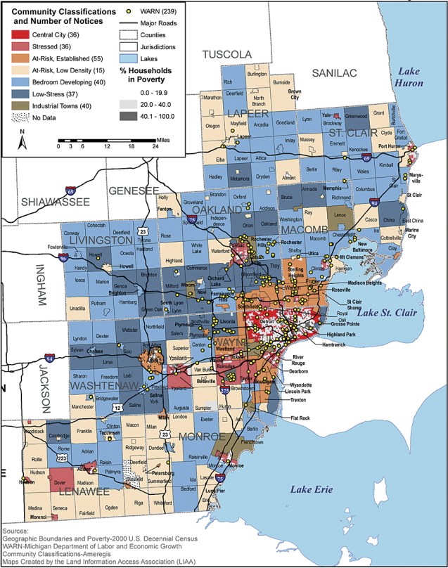
Good Jobs First has since produced a string of increasingly sophisticated studies, using Esri products in-house or with partners. The largest is The Geography of Incentives: Economic Development and Land Use in Michigan. Funded by the Charles Stewart Mott Foundation, it maps 4,000 deals in seven metro areas and sorts the deals through the lens of Myron Orfield’s community typology and other criteria. In a state hard hit by the decline of manufacturing, the most damaging images involve job loss as well as creation: it is the first time incentives have been geographically juxtaposed against plant closings and mass layoffs (as officially notified under the federal WARN Act). For the state’s most generous subsidy, the maps of the largest metro areas like Detroit, Michigan, show very few deals going to the central city or the densest inner-ring suburbs, even though those areas have suffered the vast majority of shutdowns. For some, the images conjure up redlining, the practice of geographic discrimination that banks and insurance companies have been accused of.
