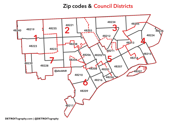
Defining geographies is difficult, especially when politics are involved. In 2009, the idea of Districts was passed on its own through City Council. In 2012, Detroit changed its City Charter and City Council elections to be based on the geographic Council District. There was intense debate about how Downtown would be divided and lines were drawn along specific city blocks.
The downside is that data doesn’t exist for Council Districts unless it is specificaly collected at the block level, which is only every 10 years by the Census Bureau. The majority of available data is at Census Tract or Zip Code level, both of which have no relation to the local political geography.
A data conundrum.

When was the last time these boundaries were updated?
Pingback: Map: Is it time for Detroit City Council Redistricting? | DETROITography
Pingback: Map: Let’s talk about Detroit ZIP Codes | DETROITography