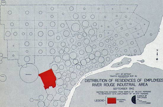
The geographic distribution of jobs and access to opportunity is a major issue of the current revitalization effort. Many people cannot easily reach jobs that they need because they are too far away in the suburbs. These maps give an interesting picture of where people lived and worked when Detroit’s major industries were moving full tilt. All in all, people mostly lived fairly close to where they worked. The Henry Ford River Rouge Plant (above) was a key employer of the day in 1942, the jobs are not as many these days. Much of their workforce was pulled from Dearborn, but a substantial number of people lived nearby across Detroit. 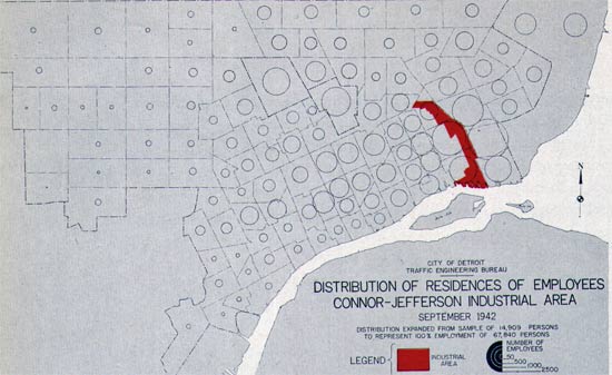
The Connor-Jefferson industrial area may be one of the few that is still very active with the Chrysler Plant going strong.
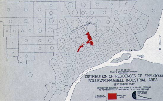 The Boulevard-Russell industrial area is not so active anymore. There are some smaller companies left, but the Russell Industrial Center houses artists and lofts rather than industrial jobs.
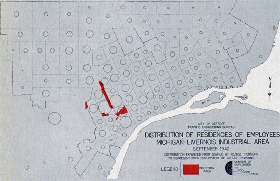 I’m not aware of any continued industrial activity in the Michigan-Livernois area besides some logistics and trucking activity. Anything else?

Very cool, there is a visually identifiable pattern. Today’s map needs to include Detroit, Ann Arbor, Lansing.
Maybe Detroit looks the way it does today because of the lack of employment opportunities