In 2010, Lars Gräbner of Volume One Studio and the University of Michigan Taubman College, began conducting a mapping study of Detroit in order to conceptualize a future for the city. The above series of maps were based on the Official Hearne Bros. Real Estate Atlas of the City of Detroit, Plats Map, Edition 500-50.
More from Lars Gräbner:
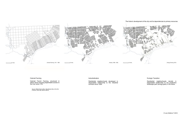
Colonial Farming
Colonial French Farming, structured in ribbon farms ensuring dependable access to the river since 1701.
Industrialization
Residential neighborhoods developed in dependable relationship to industrial corridors since 1806.
Ecologic Transition
Residential neighborhoods densify in dependable relationship to the productive landscape park (energy-park) in the future.
These maps were featured in Mapping Detroit (Chapter 8: Mapping the Urban Landscape: Revealing the Archipelago) available from the WSU Press.
