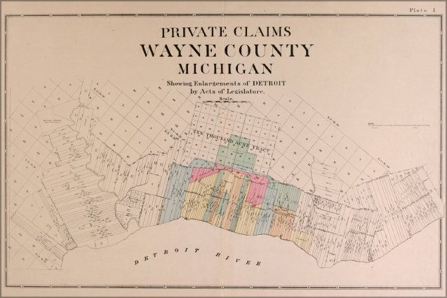
This historic map presents a colorful representation of Detroit in 1914 along with the varying land claims and land divisions that have left their mark on the city from the riverfront ribbon farms to Woodward’s 10,000 acre plot, and finally the Jefferson square mile plan.
