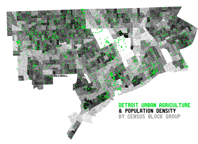
I created this map to be included with an article, titled “Urban Agriculture: It’s not a Food Desert, it’s about Food Sovereignty,” that I contributed to the Progressive Planners Network publication.
Without running any statistics, there are some obvious overlaps in where people are and the locations of gardens and farms. In particular, there is a higher density of people (and incomes) on the Westside and similarly a higher density of gardens.
The data is based on information shared by Keep Growing Detroit and the US Census Bureau.

Reblogged this on Alex B. Hill.
Thanks for creating this. Where can I find a shapefile of this?