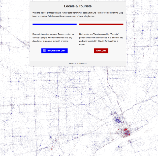
I was reminded that Erica Fischer didn’t just bring us the Racial Dot maps or the recent Geotaggers Atlas, they also dug into Twitter data to determine where “locals” and “tourists” frequent. Where “locals” are blue, the main artery roads are well marked. It appears that WSU and UDM students constitute “locals” largely due to their limited travel patterns. Similarly, “locals” seem to visit or live in New Center rather than Downtown. The Downtown and Corktown areas are bright red from all the “tourist” activity.
