From Washington Post:
His project, which draws on Census data reported by employers, is modeled off Dustin Cable’s well-known racial dot map that mapped every person in the country.
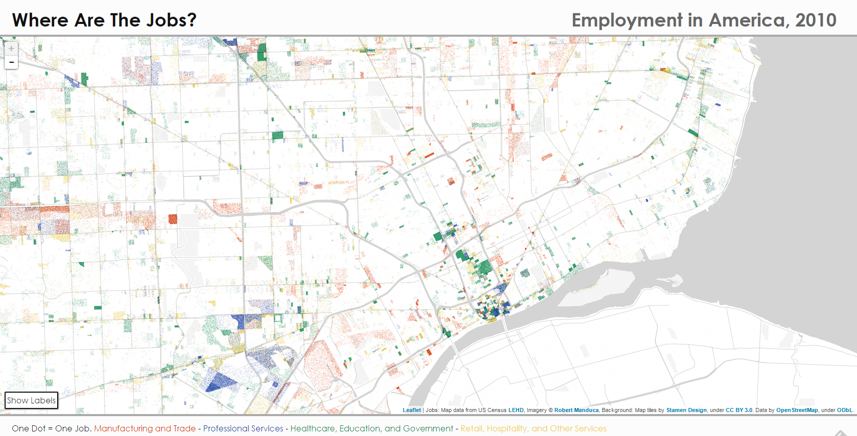
For Detroit, this project demonstrates the extreme job loss that has plagued the city for half of a century. Auto manufacturing has fled for cheaper labor, firms leave out of fear (racial, crime, etc.), and general decline has not fostered a strong jobs climate.
It is somewhat easy to make out the jobless edges of Detroit, while the areas just outside the city limits have greater job density. Downtown, Midtown, and New Center (Henry Ford Hospital, Detroit Public Schools HQ) are awash with education, medical, and professional jobs. Some manufacturing jobs can be seen following the linear city model along major expressways. Otherwise jobs in the city are spotty. This is a visual representation of the difficulties that James Robertson faced, walking 21 miles roundtrip to work a low paying job in the suburbs.
View the entire interactive project from Robert Manduca

Pingback: Map: Electric Grid Hardening vs Modernization in Detroit | DETROITography
Pingback: Map: Where are People vs. Jobs in Detroit? | DETROITography
Pingback: Map Puzzle: How well do you know your Detroit neighbors? | DETROITography