
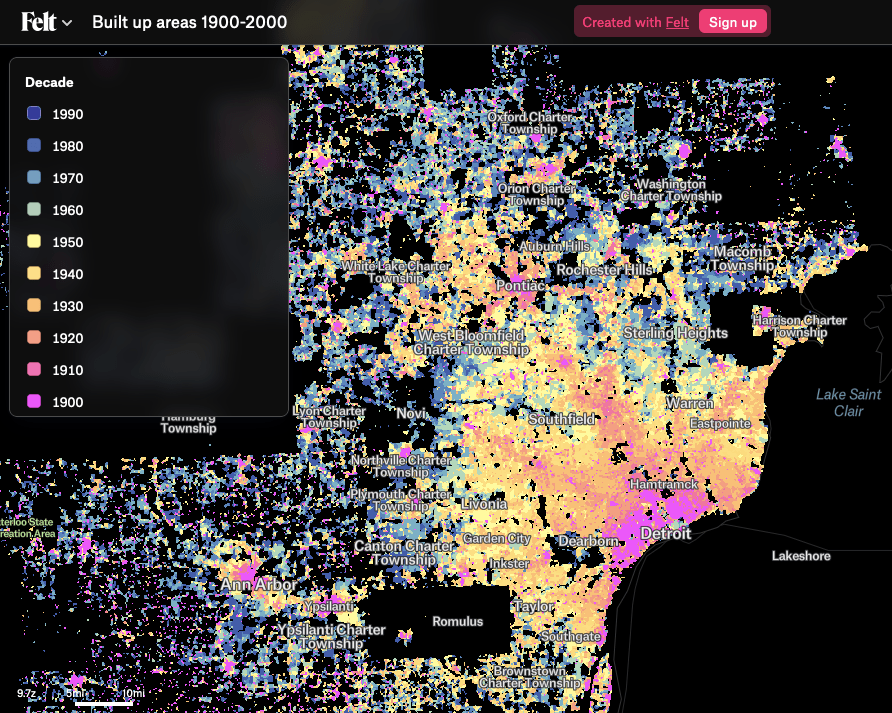
The team at Felt made a incredible map of the US from a Zillow-based dataset to explore urbanization analysis across the country. The interesting stories shine through the data in major cities, like Detroit. SEMCOG has a great hand drawn version of this map type and its really interesting that this could be recreated from Zillow data.
More from Felt,
“By the 1900s the majority of the US population lived in urban areas. This map highlights the pattern of urbanization across the continental United States between 1900 – 2000 in 10 year increments. The data were compiled by researchers at the University of Colorado, Boulder using the Zillow Transaction and Assessment Dataset and the raster layers represent the presence of at least one built-up structure at 250m spatial resolution over each time period.”
