by: Jonny Hanna
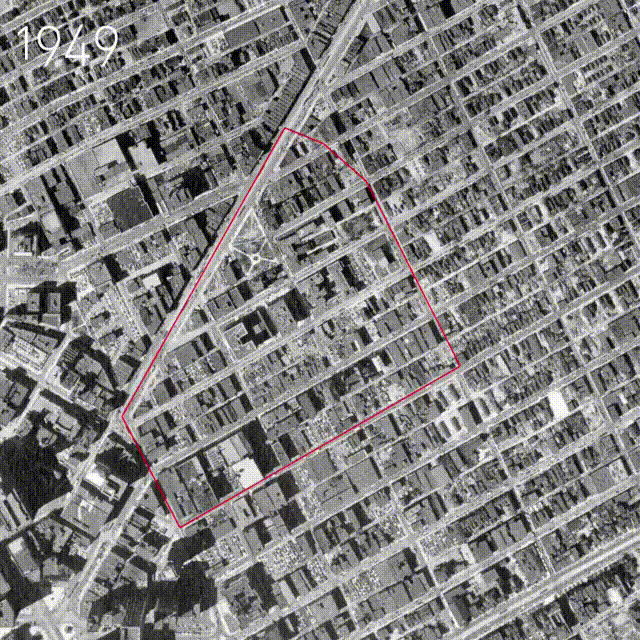
This series of aerial images was research produced as part of the Greektown Neighborhood Framework Vision. This series of aerial photographs from the DTE Aerial Photo Collection held by Wayne State University are superimposed to help tell a jarring story of priorities and the detrimental urban planning which spanned several decades in Detroit.
From the destruction of Black Bottom along Hastings Street for the creation of I-375 to the demolition of the historical Victorian fabric of the city in favor of parking garages and lots, Greektown has been reduced to “Greekblock” but yet still reveals that persistent community engagement is our only key to salvaging that which has been lost in the name of speed and technology. These maps helped influence the plan by reintroducing “Clinton Park” which existed in the city for a century before it was destroyed by the construction of the Frank Murphy Hall of Justice. With some political support the park may one day find its place back in Greektown.
Jonathan Hanna is the Design Principle of HBB Design Collaborative and Adjunct Faculty at Lawrence Technological University College of Architecture and Design
