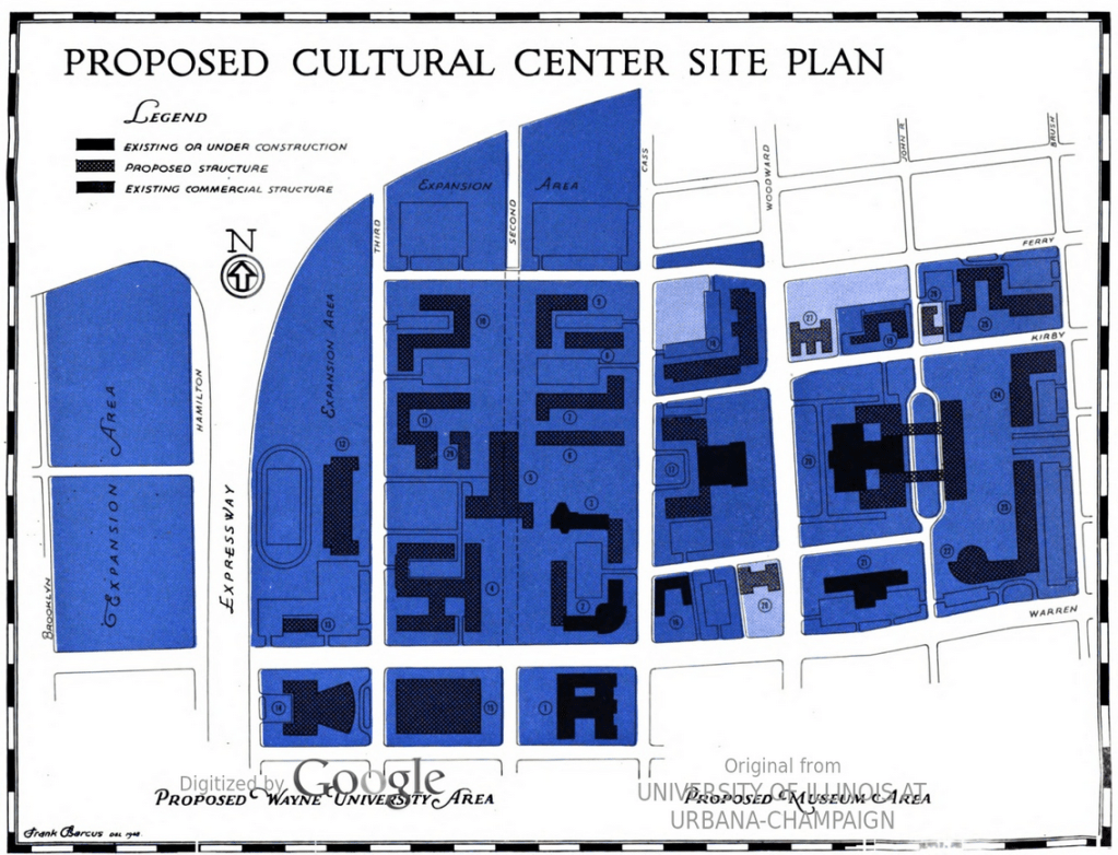
The City’s “Cultural Center” has been in concept phase since at least 1948, potentially even before the City had a City Plan Commission.
This map comes from the seventh report in the 1948 master planning series. At the time many of our current institutions were still under construction. WSU was building Science Hall, State Hall, and the Engineering Building. The Detroit Historical Society museum and International Institute weren’t yet built.
Number 20 on the map is the DIA referred to as the “Art Institute.” The planned expansion of the DIA included a boulevard and skyway bridges across John R. to a second building on what is now the CCS Main Campus, where a large Planetarium was proposed.

Might want to check your sources on the Detroit City Plan Commission; it was chartered in 1919, soon after Mayor Couzens took the helm. See Daniel Amsterdam’s “Roaring Metropolis,” among others. :)