Mark Jones, GIS Analyst at SEMCOG, shares the wall map that he made for his personal project called Woodbridge Co-Hop. He recruited 13 growers with 150 hop plants to create the “Woodbridge Wet Hop Pale Ale” with Brew Detroit.

What is your map? (Title, Year, etc.)
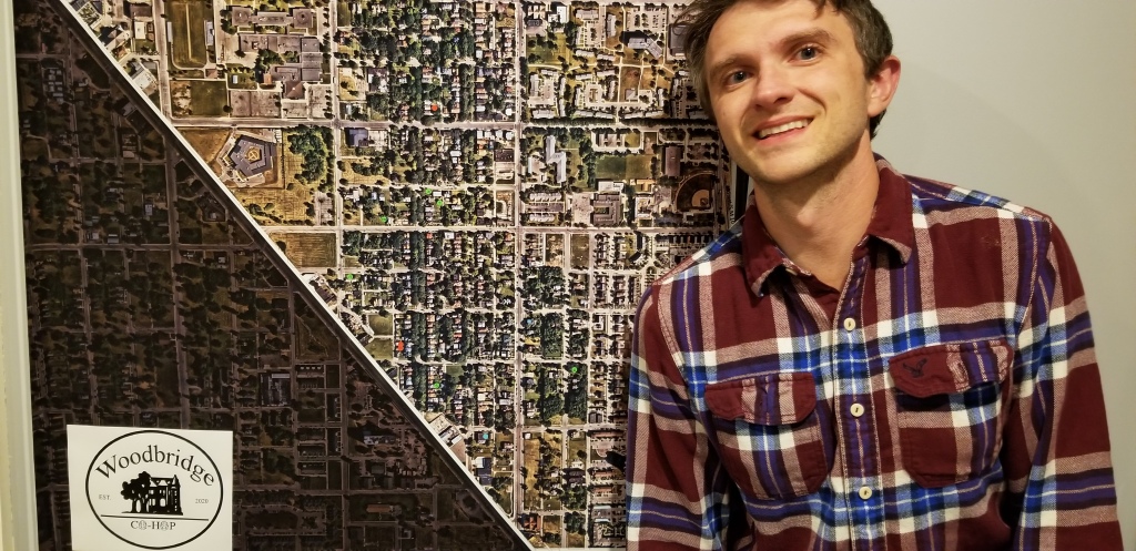
Woodbridge Co-hop planting status. In January 2020, I started a program where hop growers throughout Woodbridge combine their yearly yields and give them to Brew Detroit to brew a neighborhood beer. Yearly we will have a Woodbridge Wet Hop Pale Ale release party, with the first one occurring this Saturday.
The map itself is the Co-hop’s boundaries. I put green stickers on the properties that are involved. I had to put red stickers on the three properties that tested high in lead and we did not use them for the beer. On each green sticker, the number of hops planted is written. In the future, we will be adding more growers and there will be more stickers.
The beer will be available on tap at Brew Detroit and Woodbridge Pub. We worked out an agreement that $1 for every pint will go towards Woodbridge Neighborhood Development’s Low Income Minor Home Repair.
Where did you acquire your map?
I am a GIS Analyst at SEMCOG, so when I started the Woodbdrige Co-hop it seemed natural to print a huge map of the project’s boundaries in order to keep track where the hops are being planted and where the soil tests are coming back with high lead.
What made you hang it on your wall? What stood out to you? What details do you enjoy about the map?
The details on it change throughout the year. From the project’s conception in January to June we were gathering orders for hop plants. Then we got the soil test results in August and finally we are having new people wanting to join for next year. Plotting these locations on a map makes it easier to organize watering duties, create a walking tour, and plan out harvest day.
What in your background has drawn you to maps?
I went to graduate school for City Planning, but the spatial analyst aspect has really stuck with me. Since leaving MSU, I have focused on trying to visualize my environment and storytelling with maps.
