During the coronavirus pandemic hospital allocation and resources have been a major question that has led to greater coordination by the State of Michigan to ensure there are enough beds and staff have enough personal protective equipment (PPE).
In the late 1960s, many community hospitals were still in operation. Just in Northwest Detroit there was Mt. Carmel Mercy next to Sinai Hospital with both across the Lodge from Grace Hospital Northwest.
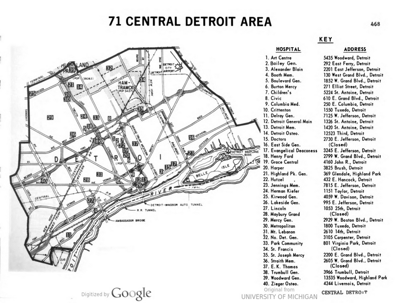
This map of the “Central Detroit” hospital planning region is where present day hospitals on concentrated with DMC and Henry Ford, but in the late 1960s had an even greater density of hospital locations. At this time “Detroit General” run by the Health Department which later became “Detroit Receiving Hospital” was still located Downtown rather than where it is today. The Art Centre hospital building is still in use on WSU’s campus although the building is half condemned.
