Map: Population Change in the Detroit Region 1960-1968

Screen Shot 2020-07-16 at 9.01.04 AM

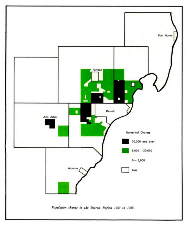
The University of Michigan at Dearborn used to have a Center for Urban Studies that completed some of the largest and most comprehensive Transportation and Land Use Study (TALUS). As part of that study their research team tracked population change and modeled population growth to the year 2000.

Leave a Reply

Fill in your details below or click an icon to log in:

WordPress.com Logo

You are commenting using your WordPress.com account. Log Out /  Change )

Twitter picture

You are commenting using your Twitter account. Log Out /  Change )

Facebook photo

You are commenting using your Facebook account. Log Out /  Change )

Connecting to %s