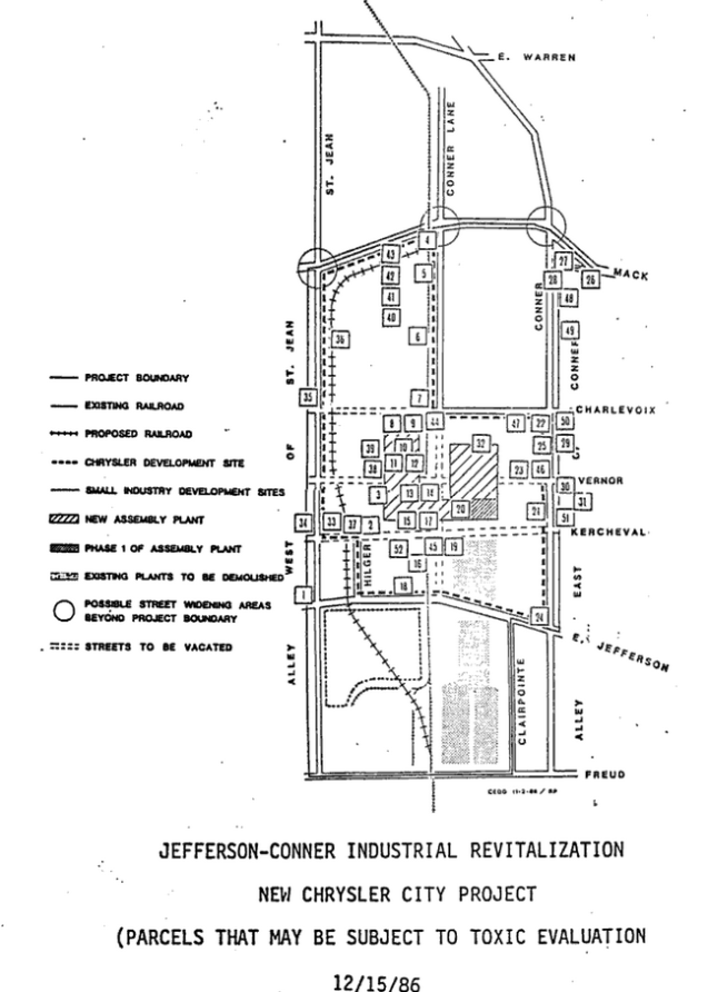
As Fiat Chrysler Automotive (FCA) finishes its recent expansion adjacent to their existing facility, including swallowing up a roadway and increasing toxic emissions on the Eastside, I happened across the original 1986 plans for what was then deemed an industrial “revitalization” for a new Chrysler plant.
The full plan is called the Jefferson-Conner Industrial Revitalization Project. The map included here represents all of the existing buildings and businesses that may be subject to toxic evaluation (i.e. removal of underground tanks at gas stations, etc.). The existing plant in faded gray was demolished.
