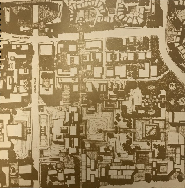
This map comes from “Detroit 1990: an Urban Design Concept for the Inner City” that the Department of City Planning published in 1970. This concept for the Cultural Center is especially interesting as competition continues to select a new concept for the DIA Plaza | Midtown Cultural Connections effort.
The City Plan Commission suggested expanding the Cultural Center in 1965 with a proposal for a large central park and long malls connecting various cultural institutions with links to the University and Medical Center areas.

Pingback: Map: Detroit Square – Transforming Cultural Center | DETROITography