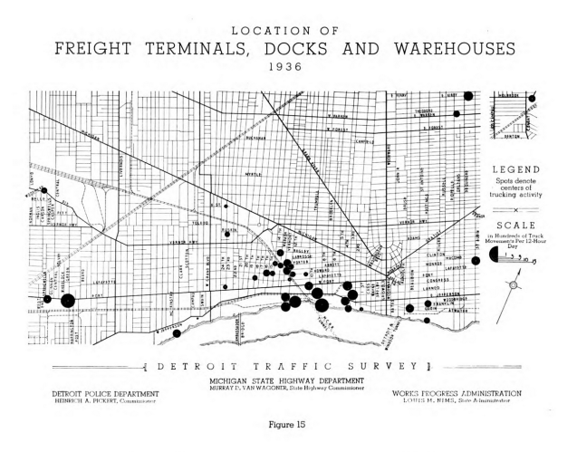
From the Detroit Traffic Survey 1936-1937, you can see a strong shift to the West of industry and freight that we still see today. Both rail and waterways made this a prime location for moving goods.
“The size of each of the black circles in Figure 15 indicates the number of truck movements to and from each terminal, dock and warehouse during a typical twelve-hour business day. Twenty-six of the largest terminals, docks and warehouses in the city are situated in the area bounded by West Grand Boulevard, Michigan Avenue, Woodward Avenue and the Detroit River.” (pg. 45)
