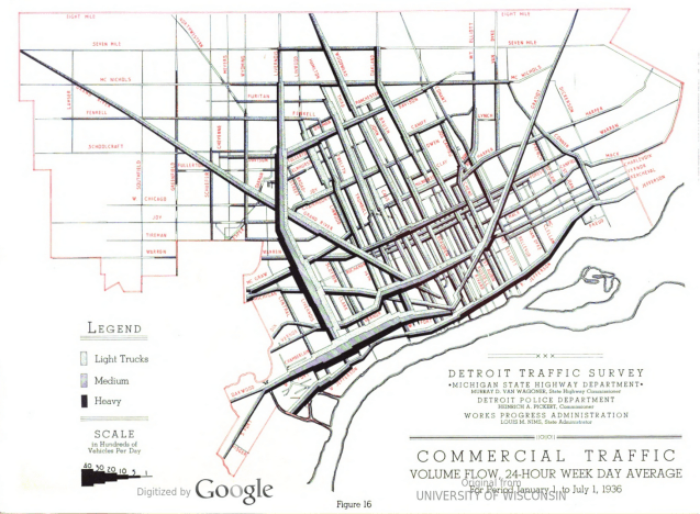
The harsh and almost disturbing display of traffic volume data makes me think of dystopian urban nightmare with duct work of varying size funneling where people can go. This map comes from the ‘Detroit Traffic Survey” conducted in 1936, published in 1937 and led to many of the freeway developments that we now see today. The data presented in this way possibly had a strong effect on the policymakers hoping to rid Detroit of the dystopian tangle of traffic congestion.
