 From the Detroit City Plan Commission’s “Central Business District Study: Land Use, Trafficways, and Transit: A Basis for the Long Range Growth of Downtown Detroit.”
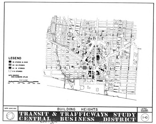
Compared to the most recent data on building heights, not too much has changed. Most notably the Renaissance Center had not yet been built (see the large empty space where Woodward ends at the Detroit River).
