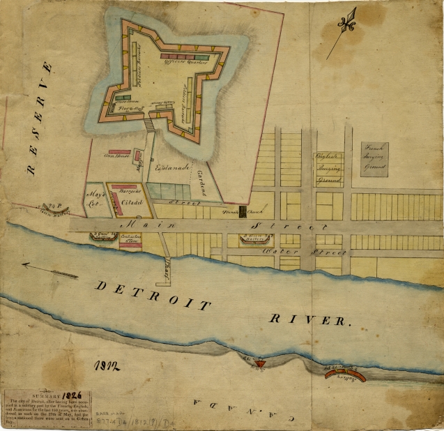
This map available in the Detroit Public Library Digital Collections, Burton Historical Collections includes the description:
“Summary. The city of Detroit, after having been occupied at a military post by the French, English, and Americans for the last 150 years, was abandoned as such on the 27th of May, and the troops stationed there were send on to Green Bay.”
It’s easy to see that Detroit was a fortified city preparing for the War of 1812 with numerous gun batteries along the river. The piece that stands out most to me are the separate English and French “burying grounds” just a block North of Woodward and Jefferson. I wonder what 19th century ghosts haunt One Detroit Center. . .

Pingback: John Fisher's Extraordinary Ledger - Ohio History Connection