Map: Detroit Public Schools 1972

det-pub-schools-1972

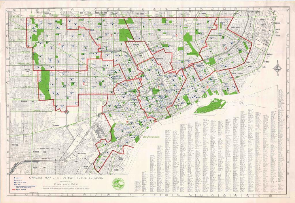
Yet another great archived map from the Detroit Historical Society. In this map you can see how Detroit evolved and grew with a higher density of schools in the older parts of the city (Greater Downtown) and more spread out schools in the annexed areas/ suburbs that later joined the city.

Leave a Reply

Fill in your details below or click an icon to log in:

WordPress.com Logo

You are commenting using your WordPress.com account. Log Out /  Change )

Twitter picture

You are commenting using your Twitter account. Log Out /  Change )

Facebook photo

You are commenting using your Facebook account. Log Out /  Change )

Connecting to %s