Loveland has been doing some important reporting and analysis (After the Fire) on fires in the city over the past year.
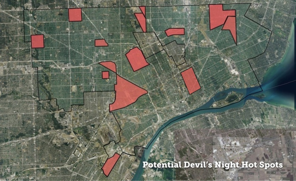
Alex Alsup created the above map to support Angel’s Night efforts based on the following criteria:
Vacant properties adjacent to occupied homes are critical to note for three reasons:
- 10% of fires (167, from January 1 ’15 thru August 1, ’15) in Detroit over the past year have been “exposure fires” — fires that spread from one building to an adjacent building.
- There have been more than twice as many fires categorized by the fire department as suspicious or arsons in vacant structures than in occupied ones (570 vacant, versus 251 occupied, from January 1 ’15 thru August 1, 2015).
- Publicly owned vacant properties can be demolished, removing potential fuel for fires and risk from occupied homes. In Hardest Hit Fund zones there are myriad instances where vacant structures adjacent to occupied homes have been removed through city demolition efforts. We hope this map can be useful to that continued work as well.
