 This map is one in the three part series considered to be the first detailed map of the Michigan Territory.
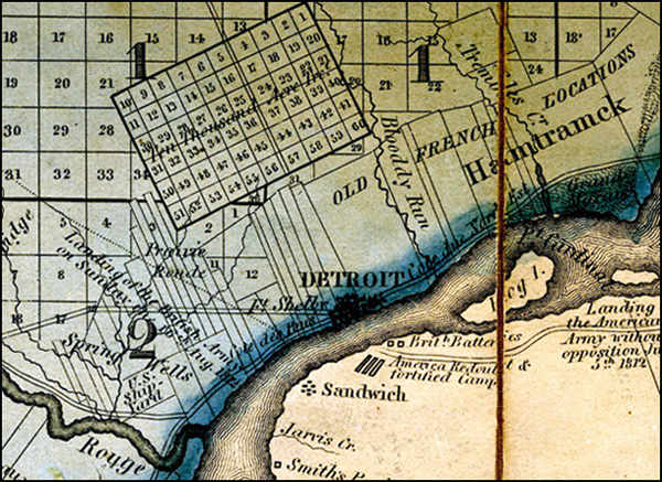
“In the map detail of Detroit we can see the clash of land division systems: Old French long lots meet up with Judge Woodward’s Ten Thousand Acre Tract and are filled in all around with the U.S. Public Land Survey System. To the southeast we can see part of Ontario, Canada, where Windsor was still called “Sandwich.” Significant sites of the War of 1812 are noted on the Windsor-Essex Peninsula.”

Pingback: Map: Village of Woodwardville Detroit? | DETROITography