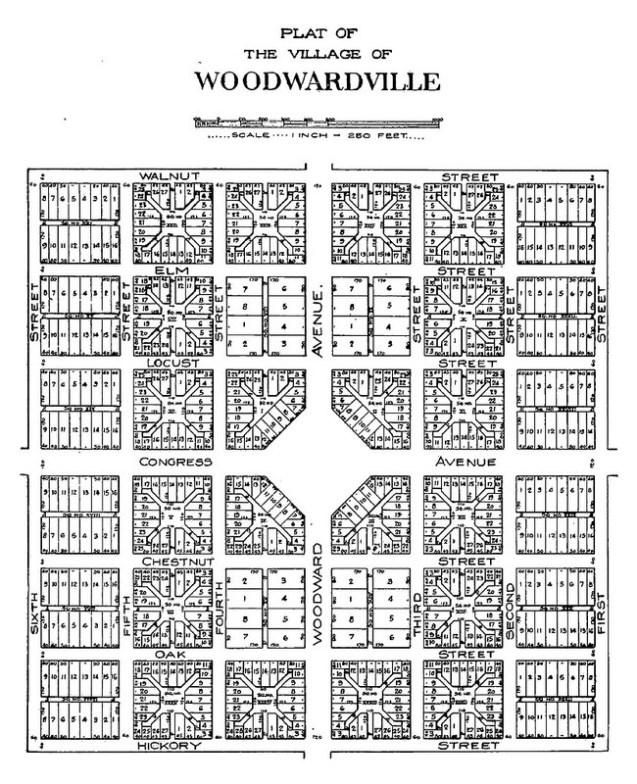
After the flop that was Judge Augustus Woodward’s “Plan of Detroit,” he purchased 8 adjacent plots in the “10,000 acre tract” and planned yet another never to be realized city, Woodwardville. Clarence Burton describes it as a “paper city” in an effort to “boom the lands adjacent to the cities.”
Read more from Paul Sewick on Detroit Urbanism:
Centered around Woodward Avenue north of what is now the Davison Freeway, the village was laid out in somewhat conventional rectangular blocks.

Isn’t Judge Woodward’s Woodswardsville now located within Highand Park?
I still don’t get it, the downtown plat was too extravagant, so he tries again with the land Jefferson said should be in city blocks? So this is Woodward and Manchester. Funny thing, it could still be done with the way its laid out.