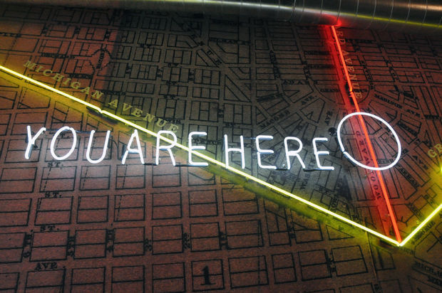
If you’ve been inside the Madison Building lobby, then you couldn’t have missed this map on the wall. There is slight problem with the location of the neon circle. The Madison Building is not off of Woodward as it seems to appear on the map, but rather off of Broadway and closer to Grand Circus Park. Hopefully the yellow neon on Michigan Ave. and Gratiot Ave. represents the next streetcar rail development that Dan Gilbert will fund?
Can anyone identify the base map that they used?
