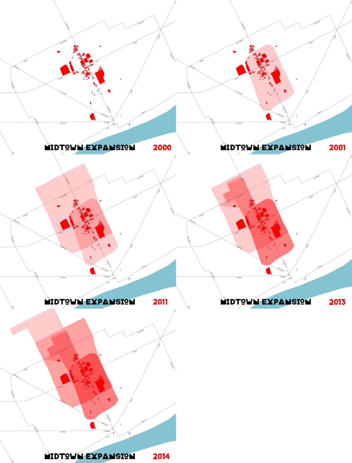
 Since 2000 the area known as Midtown has seen rapid expansion. It is important to note that even though Midtown is largely a conglomeration of various institutional partners and acts as an economic driver, there is no official geographic demarcation, which has seemingly allowed Midtown to continue reaching northward. In many instances the authority, Midtown Detroit Inc., offers incentives in an area before officially annexing it for inclusion in its official brochures. Below is a quick breakdown:
- 1890 – residents in the Midtown area represented the highest earners in the entire state of Michigan.
- 1910 – upper and middle class families began moving to Boston-Edison and Indian Village to get away from the factories, pollution, and noise
- 1943 – racially divided Woodward (white west, black east)
- 1959 – I-75 construction destroyed Paradise Valley, center of African American community, area on Hastings St.
- 1960s – the areas of Midtown on either side of Woodward ranked among the most economically disadvantaged in the state of Michigan.
- 1970s & 1980s – temporary housing in the Cass Corridor and drug deals in the open air
- 1976 – University Cultural Center Association (UCCA) founded
- 2001 – Midtown Detroit Inc. founded (detroitmidtown.com registered 01-06-2000)
- 2009 – entire Midtown area minus WSU campus was considered “empowerment zone” which meant tax credits and discounts on building improvement costs
- 2011 – UCCA merges with New Center Council, expands boundary to include Woodbridge, Northend, and New Center.
In early 2011, UCCA merged with New Center Council (NCC) and formally began doing work as Midtown Detroit, Inc. The organization has expanded its staff and geographic footprint, increased its real estate investment activities and is implementing additional programs. This new footprint incorporates TechTown and the New Center area which will allow the organization to work more closely with HFHS, University Preparatory Schools, the College for Creative Studies, TechTown and many other anchors.

Pingback: Map: Midtown or Cass Corridor? Responses from the streets of Detroit | DETROITography
Pingback: Map: The Fight for “Uptown” – Detroit’s Newest Branded Neighborhood | DETROITography
Would love to see an updated version of this gif!
Thaank you for being you