DETROITography

Menu

Skip to content
  • About
  • Our Maps
  • Events
  • Neighborhoods
  • Resources
  • Find Data
  • Learn
  • Participate

Map: City of Detroit Street and Alley Vacations

January 13, 2025 By mappingdetroit

by: Yanyun Li, Jered Dean, Houjon Ding, Raven Wright – City of Detroit

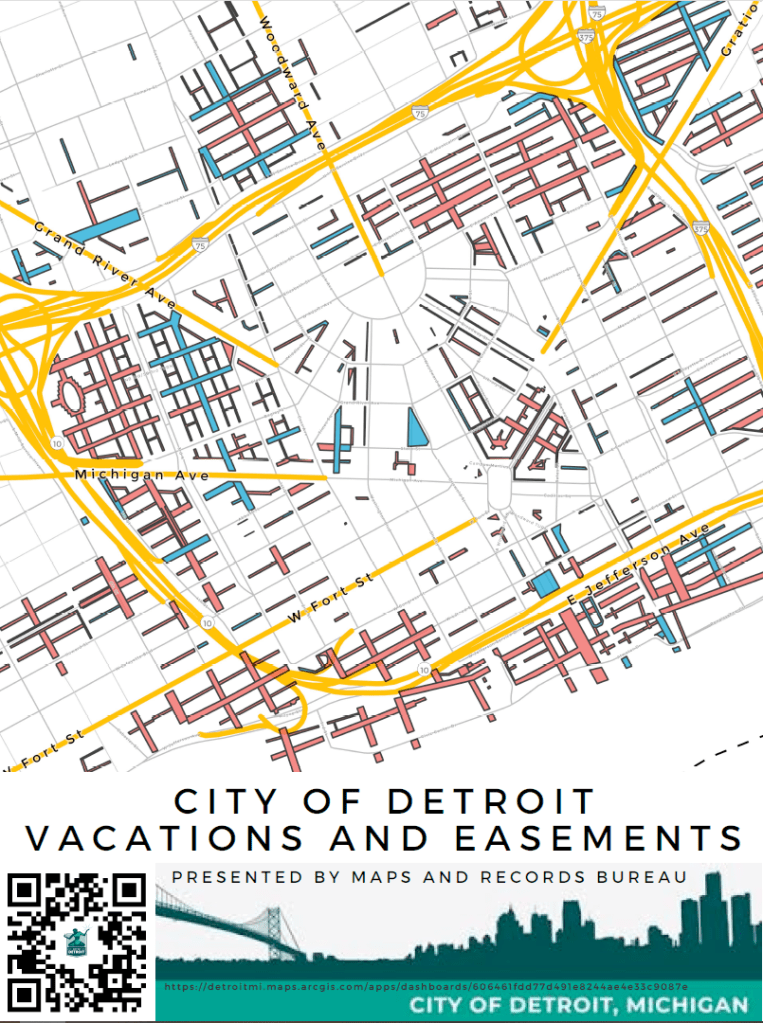
This layer indicates all streets and alleys vacated ‘Outright’ and vacated with conversion to utility easement in the City of Detroit. This layer is updated regularly.

View the interactive application

Share this:

  • Click to share on Bluesky (Opens in new window) Bluesky
  • Click to share on LinkedIn (Opens in new window) LinkedIn
  • Click to share on Nextdoor (Opens in new window) Nextdoor
  • Click to email a link to a friend (Opens in new window) Email
  • Click to share on Facebook (Opens in new window) Facebook
  • Click to share on X (Opens in new window) X
  • More
  • Click to print (Opens in new window) Print
  • Click to share on Reddit (Opens in new window) Reddit
  • Click to share on Pinterest (Opens in new window) Pinterest
Like Loading...

Related

Posted in Transit | Tagged 2024, alley, City of Detroit, Detroit, DPW, easements, geography, Houjon Ding, IMAGIN, Jered Dean, map, Maps and Records Bureau, Raven Wright, roadway, streets, utility, vacations, Yanyun Li | Leave a comment |

Post navigation

← Map: Detroit Last Houses on the Block
Map: Census 2020 Boundaries Muddle Detroit Data →

Leave a comment Cancel reply

Around Art Buildings Crime Data Demographic Economic Education Employment Environment Events Food Health History Income Land Parking Podcast Politics Population Property Race Transit

Popular

  • Detroit Redlining Map 1939
    Detroit Redlining Map 1939
  • Map: Social Justice Impacts of Transit Reductions in Detroit
    Map: Social Justice Impacts of Transit Reductions in Detroit
  • Pictorial Map of the 18th Annual Convention of the National Association of Real Estate Boards City of Detroit 1925
    Pictorial Map of the 18th Annual Convention of the National Association of Real Estate Boards City of Detroit 1925
  • About
    About
  • Map: Heat Watch Detroit 2020
    Map: Heat Watch Detroit 2020

Enter your email address to follow this blog and receive notifications of new posts by email.

Join 6,808 other subscribers

Books!

Follow

Tweets by detroitography

Like

Like
Subscribe
Create a website or blog at WordPress.com

Contact

Submit a map or just get in touch. Thanks for following!
hello@detroitography.com
×
  • Comment
  • Reblog
  • Subscribe Subscribed
    • DETROITography
    • Join 629 other subscribers
    • Already have a WordPress.com account? Log in now.
    • DETROITography
    • Subscribe Subscribed
    • Sign up
    • Log in
    • Copy shortlink
    • Report this content
    • View post in Reader
    • Manage subscriptions
    • Collapse this bar
 

Loading Comments...
 

    %d