
by: Lisa Kyle, Garrett Gillis, Noah Frey (Wayne State University)
We chose to focus on the present development of Detroit because, in our view, the city is at a crucial precipice. The latter half of the 20th century was not kind to our city — but recent blight removal projects give us a unique opportunity. That opportunity is, of course, to rebuild the city with modern values and sustainability in mind.
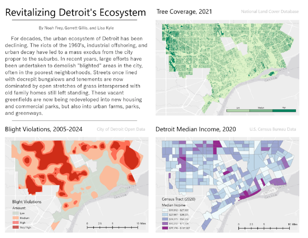
In terms of visual presentation, this project contains three maps representing different aspects of Detroit’s urban environment. We wanted the layout of the poster to be colorful, yet sleek and organized. Each map is laid out in an array so as to provide easy reference to the others. No dataset exists in a closed environment; trends, history, and real world knowledge can be obtained from a close look.
Dataset(s) Used: – Blight Violations – Current City of Detroit Neighborhoods – Joe Louis Greenway Route Segments – Park Finder
Other Research: – U.S. Census Data (2020) – Tree cover, National Land Cover Database (2021) – Detroit Daffodil Map – Bees in the D Map – City of Detroit Riverfront Trail Network Map
This map was part of the Visualizing Detroit: The Art of Data competition and exhibit in November 2024.
