
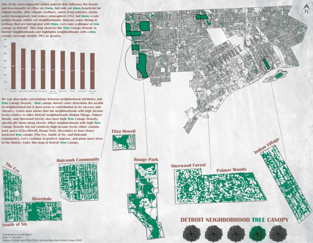
by: Kerrel Spivey
Detroit, once known as a tree-filled city before its urban decline starting in the 50s and the emerald ash borer invasion beginning in 2002, has experienced landscape change over the decades. Neighborhoods within a city can be defined by their people, setting, and character. Trees influence all three of these by improving the mood of residents, beautifying the landscape, and creating unique features. This map looks at neighborhoods with the highest tree canopy density (greater than or equal to 50%) and what we can learn about those areas because of their higher density.
Whether high tree density is lined on the streets of a neighborhood, occupy park space, or fill large backyards these areas can experience numerous benefits. From healthier environments to thermal control and from community cohesion to economic stability it is important for any urban environment to maintain and grow trees. Traveling in a neighborhood filled with sprawling sycamores and large oaks brings a feeling of tranquility and inspiration. Its clear the benefits of looming tree canopy in an area are extremely valuable. Let’s increase of tree planting efforts in Detroit for current and future generations to enjoy.
Dataset(s) Used:
– Current City of Detroit Neighborhoods
– Census 2020 Demographic Economic Data
This map was part of the Visualizing Detroit: The Art of Data competition and exhibit in November 2024.

I often have wondered if Dutch Elm Disease should be listed as one of the reasons for Detroit’s decline. Correlation, if not causation. The city became less appealing, neighborhood by neighborhood. iMike