
by: Luke Loreti
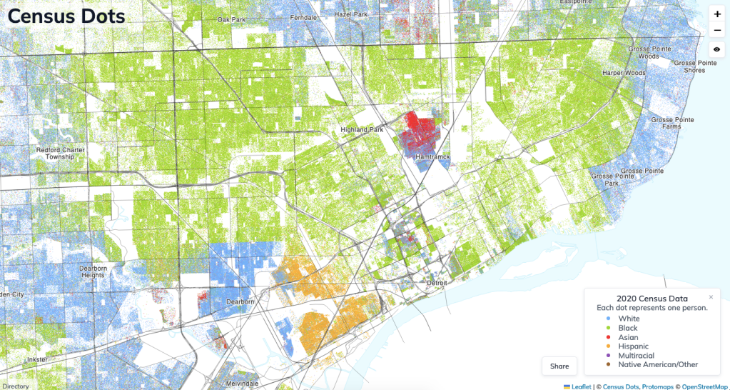
As a map nerd, I had loved Dustin Cable’s 2010 Racial Dot Map which he had created at UVA. I was saddened when this map left the internet, so as a way to get more comfortable using Census data and to learn some exciting new web map technologies, I decided to create an updated racial dot map using 2020 Census data.
Similar to previous dot maps, this map was created by combining two census data sources: the population counts published in the State Redistricting Data and the Shapefiles defining the census’s geographies. The decennial census provides population counts down to the census block level – an area roughly the size of a city block – enabling a fairly high degree of geographic accuracy. Dots are color coded based on the racial categories defined by the census. The dots within a given census block are placed randomly, which is why you might find some dots in unlikely places like parking lots or bodies of water.
The data comes together to create an extremely visually compelling map, both when viewed at the national scale and at the scale of individual regions like Metro Detroit. It often illustrates the stark divides that persist across much of the country.
This map was enabled by the previous work of Dustin Cable, Peter Richardson, Erica Fischer, Brandon Martin-Anderson, and many others, who have built similar projects.
